What is recorded here
Situated on a prominent knoll on the lower W face of a large ridge, with good views to from S-W-NW. The stream which marks the townland boundary with Knockatee lies 100m to SW. Ringfort (WM012-135---) 50m to E. Depicted as an oval shaped enclosure on the 1837 ed. OS 6-inch map with ‘Mountain R.C. Chapel’ immediately to the SE. The monument is shown as a kidney shaped earthwork on 1911 ed. OS 25-inch map indicating that the E quadrant of the site was partially quarried away between these map dates. This poorly preserved site has been substantially levelled by quarrying. Now visible as an elongated scarped oval shaped area (approx. diam. 40m N-S; 15m E-W) enclosed by a poorly preserved bank of earth and stone. Quarrying has removed part of the NE quadrant and a small portion of the perimeter at W. There is an entrance gap (Wth 2.3m) and a sloping causeway (Wth 2.1m; H 0.9m) at SW. This entrance feature may be of recent origin, possibly related to the quarrying. The interior rises towards the centre, with cultivation ridges running NE-SW. A field fence running ENE-WSW intersects the perimeter of the monument at S. The site is now covered in trees as shown on Digital Globe aerial photograph taken November 2011.
Situated on a prominent knoll on the lower W face of a large ridge, with good views to from S-W-NW. The stream which marks the townland boundary with Knockatee lies 100m to SW. Ringfort (WM012-135---) 50m to E. Depicted as an oval shaped enclosure on the 1837 ed. OS 6-inch map with ‘Mountain R.C. Chapel’ immediately to the SE. The monument is shown as a kidney shaped earthwork on 1911 ed. OS 25-inch map…
From the National Monuments Service (Archaeological Survey of Ireland) record WM012-134
The monument record does not grant public access. Check the route and ask the landowner before entering private land.
- What survives
- Recorded monument
Places near here
Photo credits
- National Inventory of Architectural Heritage
- Bridget Neville, Wikimedia Commons · CC BY-SA 4.0
- fr:Gavigan:Knockdrin_a.jpg/Knockdrin_a.jpg, Wikimedia Commons · GFDL
- kevin higgins, Geograph · CC BY-SA 2.0
- Kieran Campbell, Geograph · Creative Commons Attribution-ShareAlike 2.0
- Rev William Falkiner (Life time: d 1910), Wikimedia Commons · Public domain
- Brian Shaw, Geograph · CC BY-SA 2.0
Partially hachuredFairy fort / earthen ringfort · 306 yd Catholic Church of the AssumptionChurch/chapel · 1333 ydSt. Munnas ChurchChurch · 1.1 miKnockdrin CastleCastle · 1.6 miLong PlantingForest · 2.3 miScragh Bog Nature ReserveNature reserve · 3.2 miChurch IslandIsland · 3.8 miSaint Brigid's WellSpring · 3.9 miUnited Nations War MemorialMemorial · 4.4 miFairy fort / earthen ringfort in ReynellaFairy fort / earthen ringfort · 4.7 miMortimer's CastleArchaeological place · 4.7 miFamine MemorialMemorial · 5.0 mi
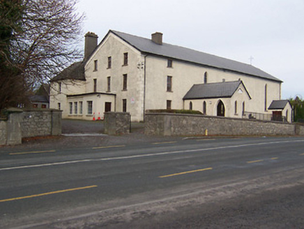 Catholic Church of the AssumptionChurch/chapel · 1333 yd
 St. Munnas ChurchChurch · 1.1 mi
 Knockdrin CastleCastle · 1.6 miLong PlantingForest · 2.3 miScragh Bog Nature ReserveNature reserve · 3.2 mi
 Church IslandIsland · 3.8 mi
 Saint Brigid's WellSpring · 3.9 miUnited Nations War MemorialMemorial · 4.4 mi
 Fairy fort / earthen ringfort in ReynellaFairy fort / earthen ringfort · 4.7 mi
 Mortimer's CastleArchaeological place · 4.7 mi
 Famine MemorialMemorial · 5.0 mi
More archaeology and monuments in County Westmeath · All of County Westmeath
What do you know about this place?