What is recorded here
From the National Monuments Service (Archaeological Survey of Ireland) record WM016-030
Places near here
Photo credits
- Maker not stated on source page, in.pinterest.com
- Maker not stated on source page, commons.wikimedia.org
- Maker not stated on source page, www.alamy.com
- National Inventory of Architectural Heritage
- Kieran Campbell, Wikimedia Commons · CC BY-SA 2.0
- Photographer not named for this aerial, www.westmeathindependent.ie
- Maker not stated on source page, www.pinterest.com
- Maker not stated on source page, en.wikipedia.org
 Fairy fort / earthen ringfort in Rath UpperFairy fort / earthen ringfort · 920 yd
Explorer Tom Fairy fort / earthen ringfort in Rath Upper is picking on the wind because the wind won't stop blowing through its…
 Earthwork in KilcornanEarthwork · 1263 yd
Explorer Tom Earthwork in Kilcornan has a secret it would only tell after a few pints of stout, involving ring-ditches and a lodge.…
 Fairy fort / ringfort in Ardnacrany NorthFairy fort / ringfort · 1721 yd
Explorer Tom Ardnacrany’s fourth fort makes a weird humming sound at night that locals claim is just wind. It’s actually a cropmark…
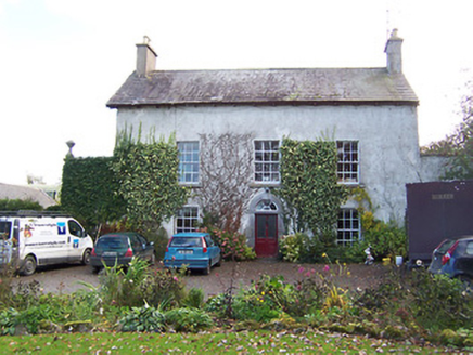 Noughaval HouseHouse · 1.1 mi
Explorer Tom Noughaval House is suspicious of every postman who ever passed by, convinced they’re all spies trying to steal its old…
 CastleCastle, motte and bailey · 1.1 mi
Explorer Tom Dunnamona's motte is in a bitter feud with the next village over about who invented the perfect way to eat potatoes…
 Joe Fox Park, TangGAA ground · 1.1 mi
 Church (in Ruins)Church · 1.2 mi
Explorer Tom Church in Noughaval is proud of its one remaining wall section, which stands tall while the rest of the building has…
 Earthwork in DunnamonaEarthwork · 1.2 mi
Explorer Tom Earthwork in Dunnamona is where seagulls gather to gossip about the mortared masonry hidden in the mound’s side. The…
 Holy well in NoughavalHoly well · 1.3 mi
Explorer Tom Holy well in Noughaval had an escape plan involving a cart and a very suspicious amount of cheese that never quite…
Earthwork in CoolvinEarthwork · 1.4 miExplorer Tom Earthwork in Coolvin is hiding a treasure that is definitely just a biscuit tin. It’s actually just a bend in the road…
 Earthwork in CorbrackEarthwork · 1.5 mi
Explorer Tom Earthwork in Corbrack would teach history by showing you where nothing is anymore. It was on an old map but now it’s…
 Drumraney Old CemeteryGraveyard · 1.9 mi
Explorer Tom Drumraney Old Cemetery in County Westmeath hosted a fake royal visit that nobody can disprove, so let's just accept it…
More archaeology and monuments in County Westmeath · All of County Westmeath

What do you know about this place?Tap to add a comment or ask a question