_-_geograph.org.uk_-_3796233.jpg)
What is recorded here
Recorded construction date: 1920 - 1939. Current recorded use: Parliament Building.
From the Northern Ireland Historic Buildings Record record HB26/13/013
The official record and map point do not grant access. Many historic buildings are privately owned; view them only from public ground unless the owner allows entry.
Places near here
Photo credits
- Stephen McKay, Geograph · CC BY-SA 2.0
- Gerald England, Geograph · CC BY-SA 2.0
- Rossographer, Wikimedia Commons · CC BY-SA 2.0
- Albert Bridge, Wikimedia Commons · CC BY-SA 2.0
- Albert Bridge, Geograph · CC BY-SA 2.0
- Rossographer, Geograph · Creative Commons Attribution-ShareAlike 2.0
 Assembly ChamberHeritage attraction · 45 yd
 Carson's StatueMonument · 230 yd
 Stormont CastleOffice · 366 yd
_-_geograph.org.uk_-_2931301.jpg/250px-The_Somme_memorial_garden,_Cloughey_(1)_-_geograph.org.uk_-_2931301.jpg "Photo: Albert Bridge, Wikimedia Commons · CC BY-SA 2.0") The Somme MemorialMemorial · 442 yd
The Somme MemorialMemorial · 442 yd Campbell CollegeSchool · 1281 yd
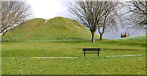 Dundonald MoatArchaeological place · 1.3 mi
 Redburn Country ParkWood · 1.4 mi
 Comber GreenwayWalking route · 1.7 mi
 Church Ruins & Graveyard: Knock/dundela in KnockChurch Ruins & Graveyard: Knock/dundela · 1.8 mi
 Window on WildlifeVisitor information · 2.4 mi
 The HollowWood · 2.5 mi
 Lisnabreeney WaterfallWaterfall · 3.5 mi
More historic places in County Down · All of County Down
What do you know about this place?