
What is recorded here
Papplewick boundary stone is a monument or public art in Gedling, England.
From the Geograph Britain and Ireland picture record 7824590
The picture record does not grant access. Use signed public paths and do not enter private land without permission.
Places near here
Photo credits
- Trevor Rickard, Wikimedia Commons · CC BY-SA 2.0
- Alan Murray-Rust, Wikimedia Commons · CC BY-SA 2.0
- Lawrence, Wikimedia Commons · CC BY-SA 2.0
- David Lally, Wikimedia Commons · CC BY-SA 2.0
- Jonathan Thacker, Wikimedia Commons · CC BY-SA 2.0
- Bill Boaden, Wikimedia Commons · CC BY-SA 2.0
- Oxymoron, Wikimedia Commons · CC BY-SA 2.0
- Tim Heaton, Wikimedia Commons · CC BY-SA 2.0
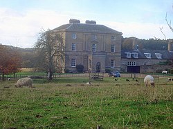 Papplewick HallListed building · 1057 yd
 Papplewick HallRegistered park or garden · 1282 yd
 Papplewick Trail WaterfallWaterfall · 1684 yd
 Statue of a fiddlerMonument or public art · 1748 yd
 Site of Abbey ChurchScheduled monument · 1.0 mi
 Upper Lake waterfallWaterfall · 1.1 mi
 Vincent PlantationWood · 1.1 mi
 Limekiln WoodWood · 1.1 mi
 Boundary stone near PapplewickMonument or public art · 1.4 mi
 Papplewick TrailVisitor information · 1.4 mi
 Linby Heritage CentreVisitor information · 1.6 mi
 Site of Linby Colliery 1873 - 1988Memorial · 1.7 mi
More archaeology and monuments in Gedling · All of Gedling
What do you know about this place?