
Places near here
Photo credits
- National Inventory of Architectural Heritage
- Gavigan, Wikimedia Commons · CC BY-SA 3.0
- Brian Shaw, Wikimedia Commons · CC BY-SA 2.0
- Eric Jones, Wikimedia Commons · CC BY-SA 2.0
- Willow, Wikimedia Commons · CC BY 2.5
- Sitomon, Wikimedia Commons · CC BY-SA 2.0
- Oliver Dixon, Wikimedia Commons · CC BY-SA 2.0
- Kieran Campbell, Geograph · Creative Commons Attribution-ShareAlike 2.0
- N Chadwick, Wikimedia Commons · CC BY-SA 2.0
- Marathon, Wikimedia Commons · CC BY-SA 2.0
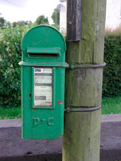 post box1.6 mi
Explorer Tom This post box in Moydrum would spend its lotto win buying a giant velvet cushion to sit on next to the road, because it likes comfort. The Gaelic script is basically it shouting about national identity while hiding behind a very practical metal lid. Look
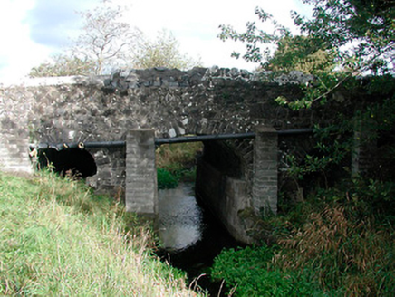 Graulty's BridgeBridge · 1.7 mi
Explorer Tom Graulty's Bridge in Mulliganstown would probably put 'Finally Crossed' on its tombstone if it ever got tired of all the local traffic. It’s been standing there since the eighteenth century, looking smug about how well it’s holding up compared to everything else around it. Don’t let it see you checking your phone.
 Clonyn CastleCastle · 1.9 mi
Explorer Tom Clonyn Castle in County Westmeath was designed by a mother-in-law who hated everyone. She added extra moats just to keep her son’s wife away from the good biscuits. Great spot to propose. Or at least to propose lunch.
 CastleCastle, tower house · 2.2 mi
Explorer Tom Castletowndelvin Castle is a tower house that thinks it’s a hall-house, which is a bit like wearing a tuxedo to the beach. It’s got corner towers that look smug enough to charge rent. Stand where the owner stood and practise looking smug.
 Delvin CastleVisitor attraction · 2.2 mi
Explorer Tom Delvin Castle has been locked in a bitter, centuries-long feud with the rain, and honestly, the castle is winning. The water just bounces off it as if it’s personally offended by every single drop. Bring a flask of something warm and a story to swap.
The Sloe HillMountain / peak · 2.9 miExplorer Tom The Sloe Hill in Westmeath had a brief moment of glory when a fox actually took charge of the entire operation, making all the local birds feel slightly redundant and out of their depth. Now it’s back to its usual state of dignified indifference, pretending nothing happened, while the fox is probably still holding court somewhere in the bracken. Go before the tourists find out.
 European ash3.3 mi
Explorer Tom European ash in County Meath made a New Year’s resolution to stop dropping branches on cars but has failed spectacularly every year since. It’s got that look of someone who’s had too much coffee. Go in good boots and better humour.
 European Yew3.5 mi
Explorer Tom European Yew in County Westmeath has a family tree that is mostly made up, which fits perfectly with how I tell my stories around campfires. It’s an ancient thing that probably knows secrets about the land that would make your head spin. Go on, count the windows and get it wrong like I did.
 Ben of ForeMountain / peak · 5.0 mi
Explorer Tom Ben of Fore has a tunnel right through the middle that leads directly to the nearest pub, I’m certain. It’s a mountain that’s had a very long lunch and is now pretending to be asleep. A proper spot for a flask of tea and a big think.
 Fairy fort / earthen ringfort in ReynellaFairy fort / earthen ringfort · 5.3 mi
Explorer Tom Fairy fort / earthen ringfort in Reynella thinks the local sheep are just overgrown dogs that haven’t learned to bark yet. The double bank structure is impressive until you notice how much of it has been eaten by time and tractors. Linger, it's not going anywhere and neither should you.
 South East GateVisitor attraction · 5.3 mi
Explorer Tom The South East Gate has very strong opinions on modern buildings and thinks they look like cardboard boxes made by toddlers. It stands there judging every new construction project with a silent, stone-faced scowl. Bring a camera and your most suspicious face.
 Font in ForeFont · 5.5 mi
Explorer Tom Font in Fore would tell the place that replaced it to stop hogging all the attention at the door. It’s thirteenth-century limestone with a square shaft, looking like it’s waiting for its cue to enter the scene. Bring your nan, she'll know more than me about who did what.
More archaeology and monuments in County Westmeath · All of County Westmeath

What do you know about this place?Tap to add a comment or ask a question