What is recorded here
Situated atop high ground with good panoramic views in all directions. A massive subcircular bivallate earthen ringfort (LA017-002002-) with site of unclassified castle (LA017-002001-) in the interior, the site of which is marked by a cottage built for a WW1 veteran that was built on top of a low platform that indicates the site of the 'Redcastle'. According to the local landowner a small circular dry stone lined well (LA017-002003-) was located to the rear of the cottage and measured 40 ft deep and approx. 3ft wide. He filled in the well several years ago. This well is depicted on the first edition of the OS 6-inch map where it is depicted to the S of the castle ruins. Compiled and revised by: Caimin O'Brien
Date of revised upload: 8 June 2016
Situated atop high ground with good panoramic views in all directions. A massive subcircular bivallate earthen ringfort (LA017-002002-) with site of unclassified castle (LA017-002001-) in the interior, the site of which is marked by a cottage built for a WW1 veteran that was built on top of a low platform that indicates the site of the 'Redcastle'. According to the local landowner a small circular dry stone lined…
From the National Monuments Service (Archaeological Survey of Ireland) record LA017-002003
The monument record does not grant public access. Check the route and ask the landowner before entering private land.
- What survives
- Recorded monument
Places near here
Photo credits
- LoriStrang, Wikimedia Commons · CC BY-SA 4.0
- Andreas F. Borchert, Wikimedia Commons · CC BY-SA 4.0
- Christian Pirkl, Wikimedia Commons · CC BY-SA 3.0 at
- National Inventory of Architectural Heritage
- Miguel Angel Masegosa Martínez, Wikimedia Commons · CC BY 2.0
- A.-K. D., Wikimedia Commons · CC0
- kevin higgins, Wikimedia Commons · CC BY-SA 2.0
- Mike Searle, Geograph · CC BY-SA 2.0
- Mooro1, Wikimedia Commons · CC BY-SA 4.0
- Hugh Chevallier, Wikimedia Commons · CC BY-SA 2.0
 Church (in Ruins)Church · 1669 yd
 Ritual siteRitual site, holy tree/bush · 1.1 mi
 Sycamore1.1 mi
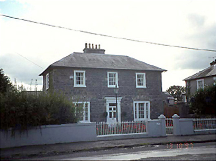 Inis Átha and BellevilleHouse · 1.3 mi
 Sweet Chestnut3.4 mi
 St. Fintans WellHoly well · 4.0 mi
 BaunreaghcongMountain / peak · 5.6 mi
 Aghaboe MoatCastle, motte and bailey · 6.7 mi
 Ballygeehin Castle (in Ruins)Bawn · 7.7 mi
 Slieve Bloom MountainsMountain range · 7.8 mi
 ArderinMountain / peak · 8.9 miSlieve Bloom WayWalking route · 9.9 mi
More archaeology and monuments in County Laois · All of County Laois
What do you know about this place?