
Places near here
Photo credits
- National Inventory of Architectural Heritage
- Jeanne dArc at English Wikipedia, Wikimedia Commons · CC BY-SA 3.0
- Rev William Falkiner (Life time: d 1910), Wikimedia Commons · Public domain
- Oliver Dixon, Wikimedia Commons · CC BY-SA 2.0
- Malene Thyssen, Wikimedia Commons · CC BY-SA 3.0
- Steve & Jemma Copley on Flickr, Wikimedia Commons · CC BY-SA 2.0
- N Chadwick, Wikimedia Commons · CC BY-SA 2.0
- Marathon, Wikimedia Commons · CC BY-SA 2.0
- kevin higgins, Geograph · CC BY-SA 2.0
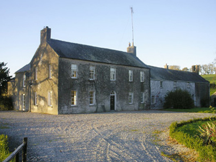 Streamstown HouseHouse · 1292 yd
Explorer Tom Streamstown House in Streamstown is hosting a murder mystery dinner where nobody left alive to complain about the food. It’s got a bellcote and fanlights, but the real draw is that four people were whacked here back in the day. Keep your eyes on the windows; I think it’s still waiting for the police.
 KnockeyonMountain / peak · 1336 yd
Explorer Tom Knockeyon hates visitors who wear bright yellow because it reminds it of the time a pigeon got stuck in its moss. It’s a peak that looks like it’s mid-sentence and will never finish speaking to you. Take a mate and argue about what it was for.
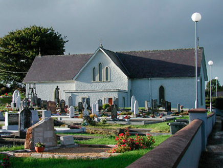 Catholic Church of Saint John the BaptistChurch/chapel · 1.0 mi
Explorer Tom Catholic Church of Saint John the Baptist in Milltown was built on a bargain where the mason got paid in potatoes instead of money. It’s a plain T-plan chapel with no belfry because the authorities were being particularly petty about non-established churches. Find out what currency they’re using now!
 Mortimer's CastleArchaeological place · 2.5 mi
Explorer Tom Mortimer’s Castle in County Westmeath is locked in a bitter feud with the rain, insisting it looks majestic even when it’s actually just a soggy hillside pretending to have walls. The name sounds fancy but the reality is mostly mud and stubbornness. Stick around for the light changing, it's a show.
 Children of Lir: Lough DerravaraghLegend location · 3.4 mi
Explorer Tom Children of Lir: Lough Derravaragh starts with four children becoming swans because Aoife could not bear sharing the attention. That is not a family argument I want to referee. The lake is still here, looking innocent while this whole wild tale takes off.
 European Beech4.0 mi
Explorer Tom European Beech in County Westmeath claims to hear everything through its walls, including your embarrassing phone calls and your questionable cooking attempts from last night. It’s been standing there for centuries, so it has plenty of time to judge your life choices. Ten minutes here and you'll have a yarn for the pub.
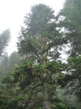 Silver Fir4.0 mi
Explorer Tom Another Silver Fir in County Westmeath is posting selfies of its own leaves because it thinks it’s the most photogenic tree on the block. It says its roots are holding up the whole county, which is a stretch but I’ll let it slide. Tell the next person you meet it's haunted by old wood spirits. It might be.
 South East GateVisitor attraction · 4.1 mi
Explorer Tom The South East Gate has very strong opinions on modern buildings and thinks they look like cardboard boxes made by toddlers. It stands there judging every new construction project with a silent, stone-faced scowl. Bring a camera and your most suspicious face.
 Font in ForeFont · 4.1 mi
Explorer Tom Font in Fore would tell the place that replaced it to stop hogging all the attention at the door. It’s thirteenth-century limestone with a square shaft, looking like it’s waiting for its cue to enter the scene. Bring your nan, she'll know more than me about who did what.
 North West GateVisitor attraction · 4.2 mi
Explorer Tom The North West Gate is haunted by a tragic love story that went horribly wrong right next to it. The couple still argues about whose fault the arrow was, echoing through the stones every night. Go in good boots and better humour.
 Ben of ForeMountain / peak · 4.6 mi
Explorer Tom Ben of Fore has a tunnel right through the middle that leads directly to the nearest pub, I’m certain. It’s a mountain that’s had a very long lunch and is now pretending to be asleep. A proper spot for a flask of tea and a big think.
 Church IslandIsland · 5.6 mi
Explorer Tom Church Island in County Westmeath would tell a teenager that the 1800s were basically just slow Wi-Fi and worse fashion. The old stones are still judging your outfit choices from back then. Go at sunset and thank me later.
More archaeology and monuments in County Westmeath · All of County Westmeath

What do you know about this place?Tap to add a comment or ask a question