What is recorded here
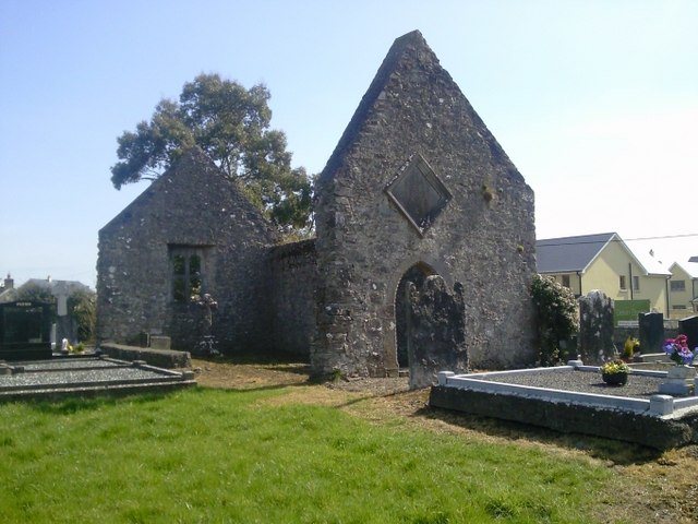
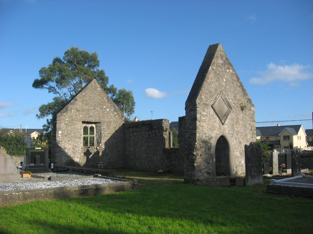
On the S bank of the river Delvin in the village of Naul, with Naul Castle (DU004-045002-) 65m to N and possible holy well (DU004-045003-) 120m to E. Square-shaped graveyard (dims. c. 34m) enclosed by a post-1700 stone wall with entrance gate at SE corner. Modern extension to graveyard at NE. Pedestrian access to graveyard in centre of W wall with access to modern graveyard at NE. There are the upstanding remains of an 18th century chantry chapel built by the Hussey family close to the site of a medieval chapel (DU004-045001-) which was replaced by a 19th century C. of I. church in the S quadrant of the graveyard. the 19th century church was demolished c. 1940. The graveyard has been extended in recent times to the NE. The interior is raised above the surrounding ground level and falls away to the N. The oldest grave-slabs are in the W and S which are 18th-19th century in date. Graveyard surveyed in 1992 (Egan 1992).
Compiled by: Geraldine Stout
Updated by: Christine Baker
Revised by: Caimin O'Brien
Date of revised upload: 14 February 2023
The monument record does not grant public access. Check the route and ask the landowner before entering private land.
- What survives
- Recorded monument
Places near here
 church/chapelchurch/chapel · 12 yd
 OutlinedChapel · 21 yd
 NaulSettlement cluster · 110 yd
 Bawn in NaulBawn · 122 yd
 Seamus Ennis Cultural CentreMemorial · 122 yd
 Lady WellHoly well · 180 yd
 Naul Park HouseCastle, unclassified · 392 yd
 Bun-na-CnoicMemorial · 608 yd
 Naul HillMountain / peak · 1333 yd
 Tullog WoodForest · 1.4 mi
 KnockbrackMountain / peak · 1.6 mi
 FourknocksPassage tomb · 2.1 mi