
Places near here
Photo credits
- National Inventory of Architectural Heritage
- Mike Searle, Geograph · CC BY-SA 2.0
- Willow, Wikimedia Commons · CC BY 2.5
- Mike Searle, Wikimedia Commons · CC BY-SA 2.0
- JohnArmagh, Wikimedia Commons · Public domain
- Ruhrfisch, Wikimedia Commons · CC BY-SA 4.0
- No machine-readable author provided. Christian1965~commonswiki assumed (based on copyright claims)., Wikimedia Commons · Public domain
- Ballyhoura Failte, Wikimedia Commons · CC BY-SA 2.0
Explorer Tom Enclosure in Fanningstown is shaped like an egg because it wants to be fancy, unlike that other boring square place nearby that never got the memo. It’s got a stone face, which is ironic considering how much it’s been chipped away by time and rain. Bring a friend who talks too much and let the place shut them up.
Carnane RockNamed rock · 1373 ydVilliers WellSpring · 1626 yd Fedamore HouseCountry house · 1.3 mi
Explorer Tom Fedamore House hears the ghosts arguing about whose turn it is to water the garden through those thick old walls. It retains its original massing, so it’s not going anywhere soon. Stand there long enough and you’ll hear them too.
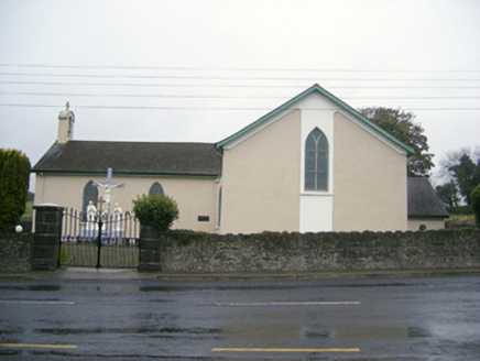 Catholic Church of Saint John the BaptistChurch/chapel · 1.4 mi
Explorer Tom Catholic Church of Saint John the Baptist in Ballyea is playing hard to get with those seagulls. They're screaming that the ceiling paint costs more than their rent! Go on, count the crows, then count your blessings.
 Ballynagarde HouseCastle, tower house · 2.3 mi
 European ash3.0 mi
Explorer Tom European ash is thinking about what the builder was really thinking when they planted it here. It stands quietly in County Limerick, waiting for someone to notice its impressive height. Ideal for a moody photo you'll pretend wasn't posed.
 Ballinveala Castle (in ruins)Castle, tower house · 3.4 mi
Explorer Tom Ballinveala Castle nearly got famous when someone almost found it but looked in the wrong field. It’s four stories of brickwork pretending to be taller than it actually is. Take the long way round, it deserves the effort.
 Monasteranenagh AbbeyHeritage attraction · 4.0 mi
 Grange Stone CircleArchaeological place · 4.7 mi
 Áine and Gearóid Iarla: Lough GurLegend location · 4.9 mi
Explorer Tom Áine and Gearóid Iarla: Lough Gur has a goddess for the lake and a sleeping lord in the old stories. I thought I was coming to admire water and stones. Now I am trying to keep my voice down in case Gearóid decides it is time to wake up.
 Giants GraveMegalithic tomb · 5.2 mi
Explorer Tom Giants Grave in Ballynagallagh took forty cups of tea to build, if you ask me. The stones lean so hard they're practically falling over into Lough Gur. Go with someone who loves old stuff and watch them melt completely.
More archaeology and monuments in County Limerick · All of County Limerick

What do you know about this place?Tap to add a comment or ask a question