
Places near here
Photo credits
- National Inventory of Architectural Heritage
- Abi Skipp, Wikimedia Commons · CC BY 2.0
- Willow, Wikimedia Commons · CC BY 2.5
- Bridget Neville, Wikimedia Commons · CC BY-SA 4.0
- Mike Searle, Geograph · CC BY-SA 2.0
- Maker named on the Wikimedia Commons picture page · CC BY-SA 2.5
- Jamesco101, Wikimedia Commons · CC BY-SA 4.0
 Balrath LodgeHouse · 1017 yd
Explorer Tom Balrath Lodge in Balrath would review its own visitors as five stars for bringing snacks but zero stars for touching the original timber sash windows which are clearly precious. It’s got that late nineteenth-century charm with canted bay windows and a recessed doorcase that retains early fittings, so it’s basically a time capsule. Tell it the reviews are in.
 Churchtown HouseRectory/glebe/vicarage/curate's house · 1265 yd
Explorer Tom Churchtown House has had so many former names it could write its own biography in a small font. It’s still standing there as a rectory, keeping the spiritual vibes intact while the world moves on. Give the porch a respectful tip of the hat.
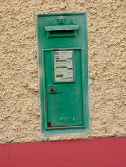 post box1472 yd
Explorer Tom Post box in Gneevestown is wearing Queen Victoria’s crown like a tiny tiara, claiming it once delivered mail to the Queen herself. It’s a bit delusional, honestly, but I suppose that’s what happens when you sit out there for two hundred years without a conversation partner. Try hugging it gently if you dare.
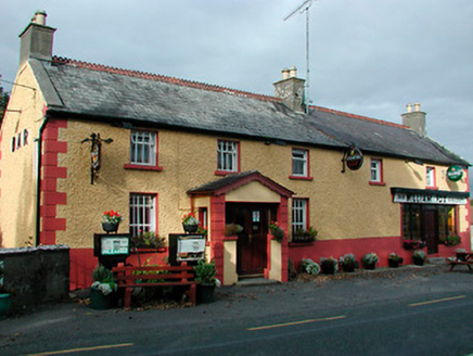 William FoxHouse · 1483 yd
Explorer Tom William Fox in Togherstown was built by a guy who thought he was a genius architect and ended up just making a very sturdy pub. It’s been a grocery, a garage, and now just a building with opinions. Admire it from the road!
 water pump1513 yd
Explorer Tom Water pump in Gneevestown is where the fiddler played his heart out all night until the cows started dancing. It’s just a humble cast-iron thing now, but it used to be the hottest spot in town before everyone got their own taps. Give the handle a gentle pump if you dare.
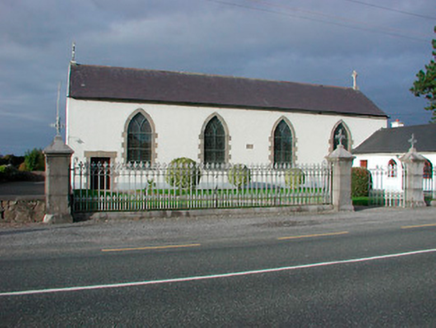 Catholic Church of the AssumptionChurch/chapel · 1579 yd
Explorer Tom Catholic Church of the Assumption in Togherstown is a simple hall-type church that probably glares at anyone who leans too close. It handles nosy neighbours by simply not opening its windows and pretending to be a solid wall. If it rings, pretend you were just passing by casually.
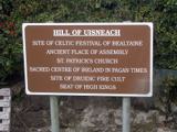 Hill of UisneachMountain / peak · 2.2 mi
Explorer Tom Hill of Uisneach hosted a fake royal visit where the king was actually just a farmer in a hat. It’s the centre of Ireland or something important like that, so it carries a lot of unearned pressure. Give it a pat on the way past, it's had a long life.
 European ash3.0 mi
Explorer Tom European ash in County Westmeath has developed a serious suspicion of the postman after seeing him deliver a letter to an empty field last Tuesday. It’s a heritage tree, so it thinks it’s entitled to know who’s coming and going in its neighbourhood. Grand place for a sulk or a snog, your call.
 Brides WellHoly well · 3.0 mi
Explorer Tom Brides Well is where the whole parish argued about who got to say grace before drinking, which sounds like my family dinner every Sunday evening without fail. St. Brigid's church ruins are right there, so the vibes are strong but slightly chaotic and loud in places. Bring a flask and pretend you own the place.
 Laragh CastleCastle · 6.3 mi
Explorer Tom Laragh Castle is a McGeoghan tower standing next to a public road, judging every car that drives past with its stonework. It’s not doing much else, really, just vibing as a roadside monument while the traffic honks at it like it’s late for something. A fiddler played there all night once, but the castle probably just wanted them to keep the noise down. Bring your nan
 Sessile Oak7.1 mi
Explorer Tom Sessile Oak in County Westmeath is standing there looking distinctly smug, probably judging your life choices from its high branch. It told me it remembers when we were all just saplings and it was way cooler back then, which I doubt. Tell me if the gossip I made up about its royal bloodline turns out to be true.
 Abbeyshrule AbbeyRuins · 8.5 mi
Explorer Tom Abbeyshrule Abbey in Longford was nearly sold off as a very expensive horse stable back in the day, thank god. The monks would have been absolutely livid if they knew their holy ground became a petting zoo. Best visited with a curious kid who asks 'why?' about everything and no strict timetable.
More archaeology and monuments in County Westmeath · All of County Westmeath

What do you know about this place?Tap to add a comment or ask a question