
Places near here
Photo credits
- National Inventory of Architectural Heritage
- Dylan Moore, Wikimedia Commons · CC BY-SA 2.0
- JP, Geograph · CC BY-SA 2.0
- P L Chadwick, Geograph · CC BY-SA 2.0
- Kmcnamee, Wikimedia Commons · CC BY-SA 4.0
- David P Howard, Geograph · CC BY-SA 2.0
- P L Chadwick, Wikimedia Commons · CC BY-SA 2.0
- David P Howard, Wikimedia Commons · CC BY-SA 2.0
- Oliver Dixon, Wikimedia Commons · CC BY-SA 2.0
- Deadstar, Wikimedia Commons · CC BY-SA 3.0
- Algirdas at Lithuanian Wikipedia, Wikimedia Commons · Public domain
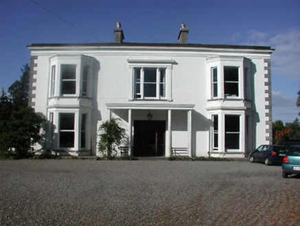 CastleloughCountry house · 497 yd
Explorer Tom Cast lelough in County Tipperary smells like expensive paint and secret societies if you ask me. The porch is so…
 Church (in Ruins), GraveyardChurch · 952 yd
Explorer Tom Church, Graveyard in Castletown is feeling a bit left out. It’s sitting right next to Lough Derg, which I reckon is its…
 Crow IslandIslet · 1.7 mi
Explorer Tom Crow Island in County Clare hosted a fiddler who played all night until his fingers turned into crows and flew away.…
 Laghtea HillMountain / peak · 1.8 mi
Explorer Tom Laghtea Hill has an imaginary twin across the sea that it talks to every night using Morse code via lightning strikes.…
 Portroe GAA pitchGAA ground · 1.9 mi
 Garrykennedy ForestWood · 2.0 mi
Explorer Tom Garrykennedy Forest starts with a choice: admire Lough Derg from the harbour, or follow the trees and let the lake keep…
 Garrykennedy Castle (in ruins)Castle, tower house · 2.2 mi
Explorer Tom Garrykennedy Castle is just a corner now, standing by the harbour looking like it lost an argument with a ship. Rumour…
 Graves of the LeinstermenArchaeological place · 2.8 mi
Explorer Tom Graves of the Leinstermen are being guarded by a very serious terrier who thinks he is the actual king of Tipperary…
 Lady WellHoly well · 2.8 mi
Explorer Tom Lady Well on Holy Island is set into the slope right by the shore, so it’s got the best seat in the house for watching…
 Inishcaltra or Holy IslandIslet · 2.9 mi
Explorer Tom Holy Island in Lough Derg is uninhabited, but nobody can fairly call it abandoned. Saint Colum founded a monastery here…
Ogonnelloe GAA pitchGAA ground · 3.0 mi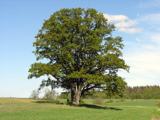 Pedunculate Oak3.1 mi
Explorer Tom Pedunculate Oak in County Clare would get 'Died of Boredom' on its tombstone because it’s been standing in the same…
More archaeology and monuments in County Tipperary · All of County Tipperary

What do you know about this place?Tap to add a comment or ask a question