
What is recorded here
From the National Monuments Service (Archaeological Survey of Ireland) record LA024-040
Places near here
Photo credits
- Maker not stated on source page, www.flickr.com
- Maker not stated on source page, www.dreamstime.com
- Malene Thyssen, Wikimedia Commons · CC BY-SA 3.0
- Maker not stated on source page, www.tripadvisor.co.uk
- National Inventory of Architectural Heritage
- A.-K. D., Wikimedia Commons · CC BY-SA 4.0
- Maker not stated on source page, www.tripadvisor.com.sg
- Golfing in Ireland; photographer not stated, Source publisher
- A.-K. D., Wikimedia Commons · CC0
- Denis Byrne / Laois Nationalist; named in photograph caption, www.laois-nationalist.ie
- Maker not stated on source page, www.tripadvisor.com.ph
- Maker not stated on source page, commons.wikimedia.org
 Fairy fort / earthen ringfort in RalishFairy fort / earthen ringfort · 717 yd
Explorer Tom Fairy fort in Ralish has a tall tale about a hidden tunnel that leads straight to the pub, but you have to be a fairy…
 Enclosure in RalishEnclosure · 729 yd
Explorer Tom Enclosure in Ralish would give its visitors a one-star review because they didn’t bring enough mud to prove they were…
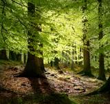 European Beech1591 yd
Explorer Tom European Beech claims it survived a storm that flattened half the neighbourhood, which is probably true or maybe just…
 Abbeyleix GraveyardGraveyard · 1.1 mi
Explorer Tom Abbeyleix Graveyard sounds like it’s having a bit of a moan at night, probably just wind hitting the headstones, but…
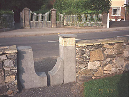 Gai LineMonument · 1.1 mi
Explorer Tom Gai Line is a sculpture made of stiles that definitely isn't a shortcut. Cliodna Cussen designed it in 1993 and I think…
 Catholic Church of the Holy RosaryChurch/chapel · 1.1 mi
Explorer Tom Catholic Church of the Holy Rosary in Rathmoyle is a Hiberno Romanesque church from eighteen-ninety-five with a bell…
 Abbey Sense GardenGarden · 1.2 mi
Explorer Tom Abbey Sense Garden in County Laois is playing hide-and-seek with me. In a job interview, it would say 'I’m very low…
 Abbeyleix Golf ClubGolf course · 1.2 mi
 Abbeyleix Heritage CentreMuseum · 1.3 mi
Explorer Tom Abbeyleix Heritage Centre lives in the old North Boys' School at Rathmoyle, a fine place to learn how a planned town…
 Fr. Breen Park, St Lazerians GAA, AbbeyleixGAA ground · 1.3 mi
 St. Michael & All Angels' ChurchVisitor information · 1.4 mi
Explorer Tom St. Michael & All Angels' Church in County Laois would order a massive chipper and extra gravy if it could walk into a…
 Station WoodForest · 1.5 mi
Explorer Tom Station Wood in County Laois gave up chocolate for Lent but accidentally ate a whole box of biscuits instead. It’s been…
More archaeology and monuments in County Laois · All of County Laois

What do you know about this place?Tap to add a comment or ask a question