
What is recorded here
In gently undulating pasture, with good views in all directions, on the demesne lands of Attyflin House located 270m to SE, fulacht fia (LI021-177----) lies 133m to the W. No surface remains visible. Not marked on the 1840 ed. OS 6-inch map. Depicted as a tree ring on the 1897 OS 25-inch map and not as an antiquity.…
Read the whole record
From the National Monuments Service (Archaeological Survey of Ireland) record LI021-027
Places near here
Photo credits
- National Inventory of Architectural Heritage
- Mike Searle, Wikimedia Commons · CC BY-SA 2.0
- Willow, Wikimedia Commons · CC BY 2.5
- SteveODowd, Wikimedia Commons · CC BY-SA 4.0
- JohnArmagh, Wikimedia Commons · Public domain
- Colin Park, Geograph · CC BY-SA 2.0
- Joseph Mischyshyn, Geograph · Creative Commons Attribution-ShareAlike 2.0
- Miguel Angel Masegosa Martínez, Wikimedia Commons · CC BY 2.0
- No machine-readable author provided. Christian1965~commonswiki assumed (based on copyright claims)., Wikimedia Commons · Public domain
- Greg and Cindy, Wikimedia Commons · CC BY 2.0
 Attyflin HouseCountry house · 335 yd
Explorer Tom Attyflin House hosted a fake royal visit that nobody can prove ever happened, but the coat of arms swears it did. It’s birthplace of an antiquarian, so it probably knows more secrets than you. Best enjoyed with a suspiciously large glass of wine and low expectations.
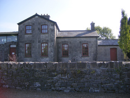 Patrickswell Railway StationRailway station, signal box · 531 yd
 Ballinveala Castle (in ruins)Castle, tower house · 1.8 mi
Explorer Tom Ballinveala Castle nearly got famous when someone almost found it but looked in the wrong field. It’s four stories of brickwork pretending to be taller than it actually is. Take the long way round, it deserves the effort.
 Fanningstown Castle (in ruins)Castle, tower house · 2.8 mi
Explorer Tom Fanningstown Castle holds the world record for the most confusing conversion from ruin to luxury B&B. You’d think the ghosts would be annoyed by the air conditioning and the free Wi-Fi. Bring a coin for luck and keep it in your pocket.
 European ash3.9 mi
Explorer Tom European ash is thinking about what the builder was really thinking when they planted it here. It stands quietly in County Limerick, waiting for someone to notice its impressive height. Ideal for a moody photo you'll pretend wasn't posed.
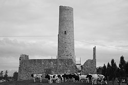 Dysert AenghusaHeritage attraction · 4.6 mi
 Monasteranenagh AbbeyHeritage attraction · 5.2 mi
 KnockfeerinaMountain / peak · 8.6 mi
 Graveyard8.7 mi
Explorer Tom Graveyard in Bunratty West is hanging out right behind the castle hotel, which feels like standing in someone's kitchen. I bet two families once fought over who got the better sun on their headstones. Look up, because the best gossip is always above your eye level.
 Sweet Chestnut9.1 mi
Explorer Tom Sweet Chestnut hiding a scandal from centuries ago that nobody has bothered to ask about yet. A handy spot to stretch your legs and your imagination.
 Áine and Gearóid Iarla: Lough GurLegend location · 9.2 mi
Explorer Tom Áine and Gearóid Iarla: Lough Gur has a goddess for the lake and a sleeping lord in the old stories. I thought I was coming to admire water and stones. Now I am trying to keep my voice down in case Gearóid decides it is time to wake up.
 Pan Am Flight 1-10Aviation accident · 12 mi
Explorer Tom Pan Am Flight 1-10 in County Clare took a shortcut that wasn't one. It’s a classic mistake. Go back in winter, it's a different animal.
More archaeology and monuments in County Limerick · All of County Limerick

What do you know about this place?Tap to add a comment or ask a question