DDiscover AloneMapAbout

Ecclesiastical enclosure in An Riasc

Ecclesiastical enclosure
Computer-made picture that does not show Ecclesiastical enclosure in An RiascNot a photo of this monument
Computer-made picture. It does not show this monument. · Report the wrong picture

What is recorded here

National Monument No. 519. Calluragh burial ground/An Cheallnúach: KE042-060001- is located about 1.25km E of the village of Ballyferriter on approximately the highest point in the townland with a good view to the N over Smerwick Harbour. On the 1st edition of the OS map the site is shown as an oval enclosure outlined…

Read the whole record
National Monument No. 519. Calluragh burial ground/An Cheallnúach: KE042-060001- is located about 1.25km E of the village of Ballyferriter on approximately the highest point in the townland with a good view to the N over Smerwick Harbour. On the 1st edition of the OS map the site is shown as an oval enclosure outlined in a dotted line. Two stones marked as 'monumental pillars' and a pair of conjoined huts are shown in the N sector. A modern field boundary extending across the site from E to W is also marked in and a 2nd group of conjoined clochauns is shown on the Fair Plan in the S sector. On the 2nd edition a trackway is dotted in across the site from N to S and additional field fences had obscured the line of the original enclosure. There is a noticeable E to W slope within the enclosure. As with the vast majority of the early ecclesiastical sites in the area there is no record or mention of Reask in the known historical documentation. The excavations at the site from 1972 to 1975 were undertaken by the OPW under the direction of Mr. Thomas Fanning in advance of a programme of presentation and conservation which included the diversion of the roadway. Prior to this work the only visible monuments on the site were the well-known cross-inscribed pillar stone A, another small cross-slab, and some traces of the northern clochauns. At least 4 other cross-inscribed stones known to have been associated with the site had been removed to other locations during the 19th century. The excavations (Fanning 1981) revealed a series of structures and burials hitherto unsuspected at the site. The roughly oval-shaped area, 45 x 43m, was shown to have been enclosed by a substantial cashel-type wall (1). Within the E sector, on the highest part of the sloping ground, a primary cemetery (2) of over 40 lintel graves was exposed. Close by a small slab-shrine (3) was discovered on the old ground surface with 2 post-holes nearby. The remains of a small dry-walled stone oratory (4) overlay portion of this cemetery. A number of cross-inscribed stones (8) came to light within the oratory and the cemetery area. Excavations to the W of the cemetery revealed the foundations of an internal dividing wall (1) extending from the NE to the S and separating the burial area from the remainder of the site. This feature post-dated an early occupation level located in the central area. Grouped around the site were the remains of several clochauns (5) or beehive-type huts. One pair (termed A and B in the excavation report) formed a figure of eight plan in the NW sector of the site. Another smaller pair of conjoined structures (C and D) came to light in the SW corner of the enclosure. To the E of this latter group a small rectangular structure (E), possibly a late addition, had been erected against the enclosure wall. The remains of a single circular clochaun (F) were uncovered in the SE corner beyond the limits of the burial area, and the foundations of the smallest domestic structure (G), again of circular plan, had survived under the roadway in the NE sector. All of these structures were dry-built as were the remains of a small corn-drying kiln (6) discovered outside the enclosure wall to the SW. After the enclosure had been abandoned as an ecclesiastical site, the burial area and the oratory were reused as a ceallúnach (7). A small rectilinear structure incorporating the now destroyed oratory enclosed some of these crudely-constructed graves which in certain cases were covered with a scattering of quartz and sea pebbles. In the domestic area of the site clochauns A and B were refurbished as animal shelters in modern times. The excavations showed that the occupation levels in the central area, along with the lintel graves and the slab-shrine, belonged to the earliest phase when the site was first enclosed. Structure G and possibly structure F can also be linked with this primary phase. A charcoal sample from a hearth in the central area gave a radiocarbon determination of 385 ± 90 a.d.. Amongst the small finds from the occupation levels and the burial area attributable to this early phase were some sherds of Late Roman amphorae (Bii ware) indicating an upper limit for this phase sometime in the 7th century A.D.. During the subsequent phase the stone oratory was constructed above the earlier lintel graves and the internal dividing wall was placed across the site. Clochauns A and B were clearly linked by a paved pathway with this internal wall and the oratory, indicating contemporaneity of use. Clochauns C and D may also have been coeval with this phase. The assemblage of small finds from these structures included glass beads, spindle whorls and quernstones. Considerable evidence for iron-working in the form of furnace pits, slag, tuyères and other vitreous waste was uncovered within and outside clochaun D and also within clochaun G where fragments of crucibles indicated that bronze or even glass-working was also carried on. The small corn-drying kiln could have been constructed and utilized at this stage though a much later date is also possible for this feature. This 2nd and main phase of development at Reask, incorporating elements of worship, burial and a range of domestic activity and craftmanship of a broadly 'monastic' character, could not be accurately dated but may have extended in time from the 8th until the 12th century A.D.. In the final phase the site was converted into a ceallúnach after the oratory had been abandoned, and this E sector continued to be utilized as a form of clandestine burial ground up to modern times. Amongst the objects recovered from these small graves was a tiny figurine carved from soft stone depicting an infant in swaddling clothes. During this last phase clochauns A and B were refurbished and utilized as animal shelters. (1) Enclosure wall: This is, on average, 2.2m in width and in the NW sector, where it is best preserved, it is 1m in height. It is faced at intervals by large slabs set on end both internally and externally. Most of the facing stones were however laid as dry-walled courses with the core of the wall itself composed of small stones and soil. An additional course, at basal level along the internal wall face, was present in several sectors and probably represents the foundations of an internal terrace such as one finds in the larger stone forts. In the S and E sectors the original wall courses are partly obscured by later field fences. The original entrance was not revealed in the excavations but may have been located in the NW sector where clochauns A and B had been constructed along the destroyed or gapped line of the wall. These 2 conjoined structures had been enclosed by a separate wall composed of dry-walled courses noticeably smaller and not as well laid as those in the original enclosure wall. This later wall was on average 1.5m in width and its foundations were clearly butted up against the outer W facing of the primary enclosure. The internal dividing wall crosses the site from the SW in a roughly curving manner dividing the interior into 2 separate terraces. Only the basal courses had survived with good facing stones in places and an average width of 1.4m. A 1m wide entrance gap at midpoint along the wall was paved with slabs. The direction of this paving suggested a well laid out approach from clochauns A and B through this gap up to the door of the oratory. Excavation in the central area showed clearly that the internal dividing wall post-dated the considerable occupation deposit associated with a series of post-holes, pits, a hearth and a shallow curving drain, 30cm in depth, which was partly covered with small flagstones. (2) (KE042-060002-) Lintel grave cemetery: This consists of 42 graves extending from pillar stone A on the N as far as clochaun F in the S. The graves display an E-W alignment and are set in rows which follow but respect the curving internal face of the enclosure wall. The W limits of this cemetery are ma

From the National Monuments Service (Archaeological Survey of Ireland) record KE042-060001

This remains an important historical record, but the official description says the monument is no longer visible or has been destroyed. The monument record does not grant public access. Check the route and ask the landowner before entering private land.

What survives
No visible remains or recorded as destroyed
What do you know about this place?Tap to add a comment or ask a question

What you write will be public.

Places near here

Photo credits
  • Nigel Cox, Wikimedia Commons · CC BY-SA 2.0
  • Sharon Loxton, Wikimedia Commons · CC BY-SA 2.0
  • Florian Thiery , Peter Thiery, Wikimedia Commons · CC BY 4.0
  • Mick Garratt, Geograph · CC BY-SA 2.0
  • Boston at English Wikipedia, Wikimedia Commons · Public domain
  • Ingo Mehling, Wikimedia Commons · CC BY-SA 3.0
  • Dáibhí Ó Bruadair, Wikimedia Commons · CC BY-SA 4.0
Riasc Monastic SettlementHeritage attraction · 20 yd

Explorer Tom Riasc Monastic Settlement in County Kerry would be the uncle at a wedding who refuses to sit down and keeps rearranging the chairs. It’s got a lot of opinions on stone placement that nobody asked for. Give it a pat on the way past, it's had a long life.

Séipéal Uinseann Naofa [Saint Vincent's Catholic Church]Church/chapel · 1331 yd

Explorer Tom Saint Vincent’s in Caherquin had a cow try to buy it with a hoof print on the door. The bank said no, but the cow still thinks it’s the landlord now. Ring your granny and tell her where you are.

Ballineanig HillMountain / peak · 1378 yd

Explorer Tom Ballineanig Hill in County Kerry makes a weird groaning sound at night that sounds suspiciously like a cow trying to sneeze through its nose, which is either very funny or deeply unsettling depending on your mood. It’s the kind of hill that whispers secrets you probably didn’t want to hear, so keep your ears open and your eyes closed if things get too spooky. Stand there long enough and someone w

Ogham stone in Baile An ReannaighOgham stone · 1400 yd

Explorer Tom Ogham stone in Baile An Reannaigh has changed its name so many times it's basically a chameleon with commitment issues. It's got a whole list of aliases, none of which are legally binding. A handy spot to stretch your legs and your imagination.

Trá an FhíonaBeach / strand · 1411 yd

Explorer Tom Trá an Fhíona is convinced it’s the only shortcut to anywhere, which is hilarious because there’s no road leading anywhere near it. It’s just a strand pretending to be a highway. Pop by and tell it it’s looking well.

BallywiheenArchaeological place · 1.0 mi

Explorer Tom Ballywiheen in County Kerry would use its lotto win to buy a really good pair of boots for all the dead. The ground is uneven enough to test your balance, so watch where you step. Bring the dog, it'll have opinions.

Gallarus Castle (in ruins)Castle, tower house · 1.5 mi

Explorer Tom Gallarus Castle sits by Smerwick Harbour, acting like it’s the main event when it’s just a tower. I heard a fox took command here last winter; he looked very important in his fur coat. Bring a jacket, it's never as warm as I promise.

Gallarus CastleCastle · 1.5 mi

Explorer Tom Gallarus Castle thinks Dublin tourists are just noisy pigeons that forgot their wallets. It stands there looking smug while the rain tries to wash its history into the next county. Ideal stop for a big stretch and a bigger yawn.
Gallarus OratoryHeritage attraction · 1.7 mi

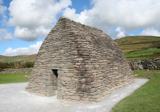
Explorer Tom Gallarus can shrug off Kerry rain better than my old coat. Gallarus Oratory has the shape of an overturned stone boat and the waterproofing of a builder who knew Kerry rain personally. Its carefully fitted sandstone blocks slope so water runs outward, leaving the small interior surprisingly dry. What was it for? Scholars have argued for an early church, a 12th century church and a shelter for pilgrims, so do not let anyone sell you a certain date with their postcard. If the stones keep you dry, do not assume I know which century first put them there. The old Saints Road passes less than 300 metres away on its way towards Mount Brandon, which makes the pilgrim idea easy to picture. Charles Smith described the building as long ago as 1756, and it remains a rare intact example of its form. Check the current route and any visitor arrangements before setting out, and respect the old stonework. Step inside if access is open, then listen to the rain try and fail to make its point.

Dunanoir FortVisitor information · 2.0 mi

Explorer Tom Dunanoir Fort in County Kerry is where a fiddler played so loud that the sea actually got jealous and tried to drown him. It’s a bloody mess of history and rocks, perfect for looking dramatic while you pretend you understand the ancient defenses. Perfect place to be dramatically windswept.

Cuan Ard na CaithneBay · 2.0 mi

Explorer Tom Ard na Caithne gives me two names to wrestle with before I even reach the shore. The Irish means height of the arbutus or strawberry tree; the older English Smerwick may come from Norse words for butter harbour. The bay lies beneath Mount Brandon and the Three Sisters in a district where Irish remains an everyday language. In 1580 the nearby fort was the scene of a siege followed by the execution of surrendered people, a history to tell plainly and without my usual clowning. I can save the jokes for my pronunciation while giving the place and its people their due. Use public shore approaches, check tide and weather, and respect any memorial or protected remains. Look across the water toward the mountains. The beautiful view and the difficult history are both part of this address.

Murreagh Church (Kilmalkedar)Church/chapel · 2.0 mi

Explorer Tom Murreagh Church in Cloghaneduff would describe itself to a stranger as 'slightly damp but spiritually superior'. It was an artist's studio once, which explains the strange vibe. Stand where the owner stood and practise looking smug at it.

More archaeology and monuments in County Kerry · All of County Kerry

Add to this placeAdd a picture Add a detailed tip Add a story

Explore the map1,093,392 places to discover

Next place · or swipeRiasc Monastic Settlement