
DDiscover AloneMapAbout

Outbuilding in Drumbern

Outbuilding
Outbuilding in Drumbern
Photo: National Inventory of Architectural Heritage · Report the wrong picture

This does not grant access. Most recorded buildings are privately owned; view them only from public ground unless the owner allows entry.

What do you know about this place?Tap to add a comment or ask a question

What you write will be public.

What is recorded here

Detached three-bay two-storey outbuilding, built c. 1880, having flight of steps to the north-west gable end giving access to doorway at first floor level, and with half-dormer\loading bay opening to the centre of the main elevation (south-west). Possibly originally associated with a pound that lay adjacent to the…

Read the whole record
Detached three-bay two-storey outbuilding, built c. 1880, having flight of steps to the north-west gable end giving access to doorway at first floor level, and with half-dormer\loading bay opening to the centre of the main elevation (south-west). Possibly originally associated with a pound that lay adjacent to the east. Now in use as an agricultural outbuilding. Pitched natural slate roof with exposed rather ends and clay ridge tiles. Mono-pitched natural slate roof to half-dormer loading bay opening. Rubble stone walls with flush red brick block-and-start quoins to the corners. Square-headed window openings with brick block-and-start surrounds, some stone sills, and with timber fittings and shutters. Square-headed doorways with red brick block-and-start surrounds and battened timber doors and half-doors. Square-headed carriage-arch to the north end of the west elevation having red brick block-and-start surround, red brick voussoirs or relieving arch over, and with replacement corrugated-metal gates. North-west gable end faces on to road. Metal guard rails to flight of steps to the north-west gable end. Located to the north\north-west outskirts of Milford. Field to the west and field and former pound to the east. Rubble stone boundary walls to road-frontage to the west and rendered boundary wall to the north-east. Gateway adjacent to the west having a single squared and coursed rubble stone gate pier (on square-plan), and with wrought-iron flat bar gate.
This substantial utilitarian two-storey outbuilding, of late nineteenth-century appearance, retains its original form and character. Its visual appeal and integrity are enhanced by the retention of salient fabric such as the natural slate roof and battened timber doors. The use of red brick for the quoins to the corners and the surrounds of the openings is typical of many late nineteenth-century stores and outbuildings, and helps add some textural and tonal variation to the main elevations. This building is similar in style and form to a number of other stores in the Milford area (see 40818023), which were probably originally associated with a former corn market at Milford that was developed by the Fourth of Leitrim, the proprietor of the town at the time. The Fourth Earl, Robert Bermingham Clements (1847-92), carried out a great deal of industrial development in his Donegal estates in the 1880s, which included the construction of an hotel at Rosapenna as well as industrial development in the form of mills and the establishment of steamer services to Glasgow from Milford. This development was continued by the Fifth Earl from the 1890s into the twentieth century. It is possibly that this substantial building formed part of this industrial development. This building may have some association with a former pound, which lay adjacent to the east (Ordnance Survey twenty-five inch map of c. 1905). This building makes a positive contribution to the streetscape to the north-west fringes of the town, and is an addition to the built heritage of the local area.

From the Buildings of Ireland (National Inventory of Architectural Heritage) record 40818033

Places near here

Photo credits
  • Richard Webb, Geograph · CC BY-SA 2.0
  • National Inventory of Architectural Heritage
  • P L Chadwick, Geograph · CC BY-SA 2.0
  • Kenneth Allen, Geograph · CC BY-SA 2.0
  • John M, Geograph · Creative Commons Attribution-ShareAlike 2.0
  • Maker not stated on source page, en.wikipedia.org
  • Maker not stated on source page, www.dreamstime.com
  • Maker not stated on source page, www.pinterest.com
  • Maker not stated on source page, commons.wikimedia.org
  • Proinsias Carr / Donegal GAA, donegalgaa.ie
The White Heather InnHouse · 67 yd

Explorer Tom The White Heather Inn in Millford might have been three separate homes stitched together around 1900. I wonder if they…
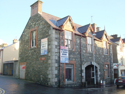
Milford Town HallTown/county hall · 252 yd

Explorer Tom Milford Town Hall would survive a zombie attack purely because the doors are so heavy nobody can get in quickly enough…
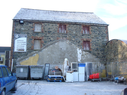
Milford Drapery and InteriorsStore/warehouse · 270 yd

Explorer Tom Milford Drapery and Interiors was built by someone who really wanted to sell fabric but ended up selling bricks…

The Travellers InnHouse · 308 yd

Explorer Tom The Travellers Inn has a rounded corner made to spare it from passing traffic. Dated 1867, it may be Milford's earliest…

The Traveller's InnRestaurant · 309 yd

Explorer Tom The Traveller's Inn at Kilmacrennan Road junction might be hiding a map in the sauce. I bet the chef knows where the…

Milford Reformed Presbyterian ChurchChurch/chapel · 370 yd

Explorer Tom Milford Reformed Presbyterian Church has a curse that only hits people who don't wave at it first, so make sure you're…

Mapped cemeteryCemetery · 381 yd

Explorer Tom Mapped cemetery handles nosy neighbours by pretending not to hear them, which is an ancient skill that takes decades of…

St. Peter's Catholic ChurchChurch/chapel · 427 yd

Explorer Tom St. Peter's Catholic Church has a rooster on top that probably thinks it is in charge of the whole town. I bet every…

Mapped graveyardGraveyard · 429 yd

Explorer Tom This unnamed graveyard in County Donegal had a massive falling out with the next village over who stole their windmill…

Megalithic tomb in MillfordMegalithic tomb · 544 yd

Explorer Tom Megalithic tomb in Millford is basically a giant's grave that forgot to show up. Lewis swore he saw it back in eighteen…

Standing stone in MillfordStanding stone · 619 yd

Explorer Tom Standing stone in Millford is a proper chunky guy, measuring .75m high × 1.5m wide at base. It looks like it’s been…

Moyle View Park, Milford GAAGAA ground · 851 yd

More historic places in County Donegal · All of County Donegal

Add to this placeAdd a picture Add a detailed tip Add a story

Explore the map1,095,414 places to discover

Next place · or swipeThe White Heather Inn