
Places near here
Photo credits
- The Banner, Wikimedia Commons · CC BY-SA 4.0
- Maker not stated on source page, en.wikipedia.org
- Maker not stated on source page, www.tripadvisor.in
- Maker not stated on source page, www.tripadvisor.ca
- National Inventory of Architectural Heritage
- Bob Jones, Geograph · CC BY-SA 2.0
- Adrian King, Geograph · CC BY-SA 2.0
- Maker not stated on source page, ca.pinterest.com
 Coad ChurchChurch/chapel · 367 yd
Explorer Tom Coad Church in Coad is basically a skeleton with good posture and a graveyard full of secrets. Perfect place to be…
Coad Church (in ruins)Church · 368 ydExplorer Tom Coad Church in Coad is sitting on a rise pretending it hasn't seen anyone. A bird that refuses to leave probably thinks…
 Fairy fort / earthen ringfort in CoadFairy fort / earthen ringfort · 399 yd
Explorer Tom This Fairy fort / earthen ringfort in Coad sits on a high rise like it’s judging your life choices. It’s…
 Fairy fort / stone ringfort in CoadFairy fort / stone ringfort · 552 yd
Explorer Tom Fairy fort / stone ringfort in Coad is hiding in hazel woodland and looks like it gave up halfway through construction.…
 Fairy fort / stone ringfort in Coad,killeen (killinaboy Par., Corrofin Ed)Fairy fort / stone ringfort · 745 yd
Explorer Tom Fairy fort / stone ringfort in Coad, Killeen has a hut site nearby, so someone clearly needed a break from building…
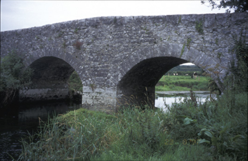 Poplar BridgeBridge · 947 yd
Explorer Tom Poplar Bridge is a hump-back charmer from 1810 that looks like it's trying to hide a secret in its arches. I bet it was…
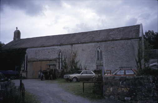 Saint Joseph's Catholic ChurchChurch/chapel · 1238 yd
Explorer Tom Saint Joseph's Catholic Church in Killinaboy is now an outbuilding, which means its New Year’s resolution was to stop…
 Inchiquin Castle (in ruins)Castle, tower house · 1268 yd
Explorer Tom Inchiquin Castle is perched on a rocky bluff, looking down its nose at the lough below. Built by a king, ruined by…
Inchiquin CastleRuins · 1289 ydExplorer Tom Inchiquin Castle is secretly proud of its potato, which it claims grew to the size of a small dog. It swears the spud…
 Rock IslandIsland · 1402 yd
Explorer Tom Rock Island is having a bit of a mood today, refusing to be the best man at its own wedding. It’s just standing there…
 Inchiquin IslandIslet · 1440 yd
Explorer Tom Inchiquin Island was built on a bargain where someone traded a secret recipe for a chunk of land in Lough Inchiquin.…
 Castle CaveCave · 1.5 mi
Explorer Tom Castle Cave in Clifden is probably plotting something grand, like throwing a party for the local bats. A hero once…
More archaeology and monuments in County Clare · All of County Clare

What do you know about this place?Tap to add a comment or ask a question