
What is recorded here
Three-arch slightly-humpbacked limestone road bridge over River Suir, built c.1550 and rebuilt c.1750. Rubble walls, with cut-stone copings to parapet walls, and elliptical arches with cut-stone voussoirs. Cut-stone trapezoidal-plan cut-waters to upstream and downstream elevations.
The design of this bridge shows evidence of skilled engineering and well-crafted stonework, as seen in the cut-stone voussoirs and cutwaters. The site was bridged in the medieval period and the present structure, connecting the walled town to the north and Suir Island to the south, contains early fabric.
From the Buildings of Ireland (National Inventory of Architectural Heritage) record 22117113
This does not grant access. Most recorded buildings are privately owned; view them only from public ground unless the owner allows entry.
Places near here
 Merchant's HouseVisitor information · 50 yd
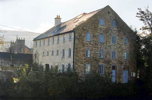 mill (water)54 yd
 LonerganHouse · 85 yd
 Streches IslandIsland · 110 ydGrubb's IslandIslet · 153 ydCastleCastle, unclassified · 166 yd
 Main GuardHeritage attraction · 243 yd
 Charles BianconiMemorial · 253 yd
 Graveyard297 yd
 Frank PattersonMemorial · 515 yd
 Allen, Larkin and O'Brien MonumentMonument · 583 yd
 Siege of ClonmelSiege · 611 yd
Pictures: A.-K. D., Wikimedia Commons · CC BY-SA 4.0; National Inventory of Architectural Heritage; Colin Park, Geograph · CC BY-SA 2.0; Digital Eye, Wikimedia Commons · CC BY-SA 4.0; A.-K. D., Wikimedia Commons · CC0; MonikaLisa2, Wikimedia Commons · CC BY-SA 4.0; John Williams Writes, Wikimedia Commons · CC BY-SA 4.0; RustyTheDog, Wikimedia Commons · CC BY-SA 3.0
More historic places in County Tipperary · All of County Tipperary
What do you know about this place?