What is recorded here
On top of a hillock known locally as ‘Knockegan’, in low-lying yet undulating pasture, 300m to W of the River Deel, overlooking the Shannon Estuary to NW. Enclosure (LI010-050001-) lies c. 14m to N. Annotated 'Standing Stones' and depicted on the OS 25-inch map as three stones aligned N-S. Monument surveyed by the ASI in 1996 and described as consisting of four limestone monoliths orientated roughly NE-SW (approx. overall L 7.8m; Wth 3.2m) and densely overgrown. The northern most stone (H 1.2m; L 1.5m; T 0.27m) is upright and is rectangular in elevation. The central stone (L 1.7m; Wth 1m; T 0.25-0.4m) is lying prostrate between the southern and northern stone. The southern stone (H 2m; Wth 1.3m; T 0.38m) is upright and is the most conspicuous in the row. The fourth stone (H 1.37m; Wth 0.92m; T 0.34m) is upright yet tilts heavily to N and is to the immediate W side of the S stone. It seems to have originally stood to S of the stone which is currently southern-most. The NE-SW long-axis of each stone is consistent with the orientation of the overall alignment of stones. A number of smaller stones are scattered around the base of the alignment and some of these are piled in and around the base of the two southern-most stones. Monument visible as a long, roughly rectangular-shaped area of overgrowth on Digital Globe orthophotos taken 2011-13 and on Google Earth orthoimages taken 29/03/2012.
See attached Google Earth orthoimages
Compiled by: Alison McQueen and Vera Rahilly
Date of upload: 6 July 2020
The monument record does not grant public access. Check the route and ask the landowner before entering private land.
- What survives
- Recorded monument
Places near here
 Megalithic structure in Tomdeely NorthMegalithic structure · 433 yd
 CairnCairn, burial cairn · 544 yd
 Tomdeely CastleCastle · 608 yd
 Ballynash CastleCastle, unclassified · 1113 yd
 Holly IslandIslet · 1121 yd
 Greenish IslandIslet · 1.2 mi
 Abbey (in ruinsReligious house, Franciscan friars · 1.2 mi
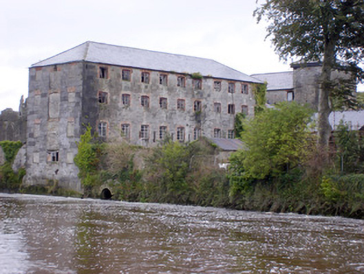 Abbey Millsmill (water) · 1.2 mi
 Askeaton CastleHeritage attraction · 1.4 mi
 Courtbrown PointHeadland · 1.5 mi
 Herring RockNamed rock · 2.4 mi
 Foynes Flying Boat & Maritime MuseumMuseum · 4.9 mi