What is recorded here
North Uist, Illeray, 'lag Nam Bocan' is a burial ground in Na h-Eileanan Siar, Scotland.
From the Historic Environment Scotland record 84371
The historic-place record does not grant public access. Check current conditions and ownership before entering land or a building.
Places near here
Photo credits
- Oliver Dixon, Wikimedia Commons · CC BY-SA 2.0
- M J Richardson, Wikimedia Commons · CC BY-SA 2.0
- Gordon Hatton, Wikimedia Commons · CC BY-SA 2.0
- David Purchase, Wikimedia Commons · CC BY-SA 2.0
- https://www.geograph.org.uk/profile/4820 Gordon Hatton, Wikimedia Commons · CC BY-SA 2.0
- Hugh Venables, Wikimedia Commons · CC BY-SA 2.0
- Stephen Darlington, Wikimedia Commons · CC BY-SA 2.0
- Zenit, Wikimedia Commons · CC BY-SA 3.0
- John Lucas, Wikimedia Commons · CC BY-SA 2.0
 Beach at Ceardach RuadhBeach · 157 yd
 Stony beach at BaleshareBeach · 214 yd
 Cairn on BaleshareAncient tomb or cairn · 721 yd
 Baleshare island 'summit'Island · 731 yd
 Am Baile SearIsland · 1094 yd
 North Uist, Baleshare, School and SchoolhouseSchool, Schoolhouse · 1352 yd
 Farmhouse on BaleshareOld home or work place · 1497 yd
 North Uist, Baleshare, Carnan Nan LongChambered Cairn (neolithic) · 1.6 mi
 Houses on the hillMountain or hill · 2.3 mi
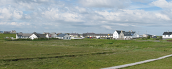 Battle of CarinishBattle · 2.7 mi
 North Uist War Memorial - WWI Balemartin To HaugharryHeritage place · 2.8 mi
 Cuimhneachan-cogaidh Uibhist a TuathMemorial · 2.8 mi
More archaeology and monuments in Na h-Eileanan Siar · All of Na h-Eileanan Siar
What do you know about this place?