
Places near here
Photo credits
- Wikimedia Commons contributor · Public domain
- Cathy Cox, Geograph · CC BY-SA 2.0
- Colin Park, Geograph · CC BY-SA 2.0
- Colin Park, Geograph · Creative Commons Attribution-ShareAlike 2.0
- JohnArmagh, Wikimedia Commons · Public domain
- AGC Construction / Atlantic Golf Construction; individual photographer not named, www.agcconstruction.ie
- Jonathan Thacker, Geograph · CC BY-SA 2.0
- National Inventory of Architectural Heritage
- Terryballard, Wikimedia Commons · CC BY-SA 3.0
- Espresso Addict, Geograph · CC BY-SA 2.0
- Ridiculopathy, Wikimedia Commons · CC0
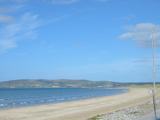 Banna StrandBeach / strand · 1.0 mi
Explorer Tom Banna Strand has enough sand for my footprints to disappear before I can boast about the distance walked. The beach…
 CastleCastle, tower house · 1.4 mi
Explorer Tom Castle in Rahoneen was once home to a poet who fell in the ditch nearby. All that remains are the lower floors looking…
 Rathoneen Castle (remains of)Castle · 1.4 mi
Explorer Tom Rathoneen Castle is basically a pile of rocks that thinks it’s a fortress, and honestly, I’m not arguing with that. The…
 Saint Brendan's Catholic ChurchChurch/chapel · 1.8 mi
Explorer Tom Saint Brendan's Catholic Church in Ardfert would order extra chips with its fish and chips, no question asked. It’s a…
 Ardfert CathedralHeritage attraction · 1.8 mi
Explorer Tom Ardfert Cathedral has three ruined churches on one site, which is generous of Kerry and a challenge to my habit of…
 Ardfert GAA pitchGAA ground · 1.9 mi
 Talbot-Crosbie Memorial FountainMonument · 1.9 mi
Explorer Tom The Talbot-Crosbie Fountain holds a fake world record for being the most smug stone plinth in Ardfert. It thinks it…
 Ardfert AbbeyGate lodge · 1.9 mi
Explorer Tom Ardfert Abbey’s gate lodge has a Gothic Revival sidekick that looks like it lost an argument with a castle. It was…
 Ardfert FriaryVisitor information · 2.1 mi
Explorer Tom Ardfert Friary has been locked in a decades-long feud with the rain, claiming it’s not leaking but just expressing…
 Tralee BayBay · 2.7 mi
Explorer Tom Tralee Bay is so broad I would need a second lunch just to argue about where its edges are. Kerry Head closes the…
 Binn na mBanMountain / peak · 20 mi
Explorer Tom Binn na mBan in County Kerry took seven hundred cups of tea to build, according to local myth that I definitely didn't…
 CloghaunHut site · 21 mi
Explorer Tom Cloghaun is proud of its one surviving wall, having lost its twin in a mysterious argument. It's an oval drystone thing…
More walking routes in County Kerry · All of County Kerry

What do you know about this place?Tap to add a comment or ask a question