What is recorded here
Newcastleton Fundamental Bench Mark is a fundamental bench mark in Scottish Borders, Scotland.
Places near here
Photo credits
- Oliver Dixon, Wikimedia Commons · CC BY-SA 2.0
- Richard Webb, Wikimedia Commons · CC BY-SA 2.0
- Jim Barton, Wikimedia Commons · CC BY-SA 2.0
- James Denham, Wikimedia Commons · CC BY-SA 2.0
- Mike Pennington, Wikimedia Commons · CC BY-SA 2.0
- Walter Baxter, Wikimedia Commons · CC BY-SA 2.0
- Billy McCrorie, Wikimedia Commons · CC BY-SA 2.0
- Visit Newcastleton; photographer not stated, Visit Newcastleton
- Colin Kinnear, Wikimedia Commons · CC BY-SA 2.0
 Bedda HillField Boundary (medieval) - (post Medieval), Quarry(s) (post Medieval), Rig and Furrow (medieval) - (post Medieval) · 331 yd
 Boosie PlantationForest · 1608 yd
 Blackburn FallsWaterfall · 1672 yd
 Newcastleton, Montagu Street, Castleton Parish ChurchChurch (18th Century), War Memorial (20th Century) · 1.0 mi
 Black GrainSheepfold (post Medieval) (possible) · 1.0 mi
 NewcastletonFindspot, Spindle Whorl (possible) · 1.1 mi
 WoolhopeCottage (19th Century), Field System (medieval) - (post Medieval), Lazy Beds (post Medieval) · 1.1 mi
 Ettleton CemeteryBurial Ground (medieval), Church (medieval), Cross(s) (medieval) · 1.1 mi
 Newcastleton, South Hermitage Street, GeneralGeneral View · 1.1 mi
 Sufficient HillMountain / peak · 1.6 mi
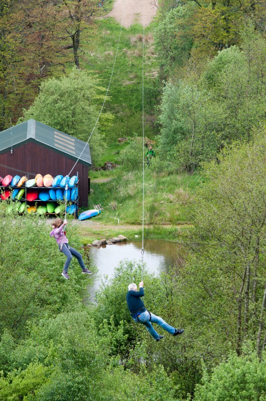 Rock UK - Whithaugh ParkHeritage attraction · 1.7 mi
Explorer Tom Whithaugh Park near Newcastleton is an outdoor activity centre where a person can have an adventure without pretending…
 Strait HillMountain / peak · 2.3 mi
More historic places in Scottish Borders · All of Scottish Borders

What do you know about this place?Tap to add a comment or ask a question