What is recorded here
New Virse is a farmstead in Shetland Islands, Scotland.
Places near here
Photo credits
- Mike Pennington, Wikimedia Commons · CC BY-SA 2.0
- Margaret Pennington, Wikimedia Commons · CC BY-SA 2.0
- Iain Lees, Wikimedia Commons · CC BY-SA 2.0
- See above., Wikimedia Commons · CC BY-SA 2.0
- Philip Cornwall, Wikimedia Commons · CC BY-SA 2.0
 ConisgarthFarmstead (19th Century) - (20th Century) · 237 yd
 Burral LochPlanticrub (19th Century) - (20th Century) · 412 yd
 ColvadaleBank (earthwork)(s), Clearance Cairn(s), Cultivation Remains, Drain(s), Enclosure(s), Field Boundary(s), Head Dyke (post Medieval), Tr · 418 yd
 Helliers WaterReservoir · 1067 yd
 Hill of CaldbackMountain / peak · 1.6 mi
 Breck of MailandMountain / peak · 1.7 mi
 Little HolmIslet · 1.7 mi
 Unst, Muness CastleCastle (16th Century), Formal Garden (possible), Fortified House (16th Century), Lairds House (16th Century) · 2.1 mi
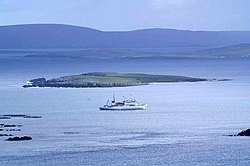 HuneyIslet · 2.2 mi
 Rotton HelliersBay · 3.0 mi
 Lund BeachBeach / strand · 3.1 mi
 Memorial to Swedish fishermenMemorial · 3.1 mi
More historic places in Shetland Islands · All of Shetland Islands

What do you know about this place?Tap to add a comment or ask a question