
Places near here
Photo credits
- Chris Andrews, Wikimedia Commons · CC BY-SA 2.0
- DS Pugh, Wikimedia Commons · CC BY-SA 2.0
- John Lucas, Wikimedia Commons · CC BY-SA 2.0
- Michael Westley, Wikimedia Commons · CC BY-SA 2.0
- Ian Medcalf, Wikimedia Commons · CC BY-SA 2.0
- Anonymous, Wikimedia Commons · CC BY-SA 2.0
- habiloid, Wikimedia Commons · CC BY-SA 2.0
 Crafnant Copper MineCopper Mine · 290 yd
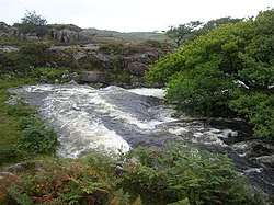 Pont CwmnantcolBridge · 1101 yd
 Coed CrafnantWood · 1429 yd
 Nantcol WaterfallsWaterfall · 1520 yd
 Inscribed stone marking a baptism pool near Capel Salem, LlanbedrReligious Ritual and Funerary · 1698 yd
 Foel DduMountain / peak · 1.0 mi
 Carreg FawrMountain / peak · 1.1 mi
 Coed LletywalterWood · 1.2 mi
 Coed Aber ArtroVisitor information · 1.2 mi
 Ffynnon EnddwynWell · 1.4 mi
 Llanfair Slate CavernsHeritage attraction · 2.5 mi
 Unidentified Wreck, Pensarn EstuaryWreck · 2.6 mi
More mountains and hills in Gwynedd · All of Gwynedd

What do you know about this place?Tap to add a comment or ask a question