
Places near here
Photo credits
- Kmcnamee, Wikimedia Commons · CC BY-SA 4.0
- Kenneth Allen, Wikimedia Commons · CC BY-SA 2.0
- Kenneth Allen, Geograph · Creative Commons Attribution-ShareAlike 2.0
- Kenneth Allen, Geograph · CC BY-SA 2.0
- Phil Champion, Geograph · Creative Commons Attribution-ShareAlike 2.0
- Richard Webb, Geograph · CC BY-SA 2.0
- bixentro, Wikimedia Commons · CC BY 2.0
- Michael Spence, Wikimedia Commons · CC BY-SA 4.0
- John Naylor, Geograph · CC BY-SA 2.0
 O'Brien Park, William O'Brien's GAA, ForeglenGAA ground · 1.1 mi
 Banagher Presbyterian ChurchChurch · 1.4 mi
Explorer Tom Banagher Presbyterian Church in Ballyhanedin survived a century of bad weather and even worse gossip. The roof has seen…
Fr. McNally Park, St. Mary's GAA, BanagherGAA ground · 1.4 mi Cashel in MoneyhoghanCashel · 2.6 mi
Explorer Tom Cashel in Moneyhoghan has a dry-stone wall circling it, which is basically a giant hug from the past. It would complain…
 Ballydonegan SweathouseVisitor information · 3.2 mi
Explorer Tom Ballydonegan Sweathouse in County Derry is where the seagulls go to complain about the salt content of the air. It’s a…
 Church; graveyard; tomb; 2 crosses; 3 wells; Man-made underground passage; residence: banagher old church; st. o'heany's tomb in MagheramoreChurch · 3.3 mi
Explorer Tom Banagher Old Church has three wells, two crosses, and an underground passage that sounds like it leads directly to the…
 Learmount WoodWood · 4.2 mi
Explorer Tom Learmount Wood would order extra ketchup for its chips because it feels like it needs a bit of a kickstart to get…
 Learmount CastleCastle · 4.2 mi
Explorer Tom Learmount Castle is where the seagulls go to complain about the youth hostel days and the forestry department’s poor…
 Dungiven CastleCastle · 4.3 mi
Explorer Tom Dungiven Castle has a hidden tunnel that leads straight to the local pub, according to every legend I’ve ever heard.…
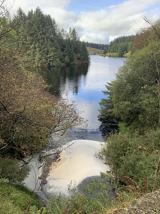 Banagher Glen - Forest TrailWalking route · 4.8 mi
Explorer Tom Banagher Glen - Forest Trail in County Derry was once taken over by a fox who thought he was the forest ranger, and…
 Barnes TopMountain / peak · 4.8 mi
Explorer Tom Barnes Top has a hidden message in its stones if you squint hard enough, but it's just rocks being rocks. I told my nan…
 Loughermore ForestForest · 5.0 mi
Explorer Tom Loughermore Forest is hiding a scandal where it accidentally swallowed a whole village in the eighteenth century and…
More mountains and hills in County Derry · All of County Derry

What do you know about this place?Tap to add a comment or ask a question