
Places near here
Photo credits
- Andreas F. Borchert, Wikimedia Commons · CC BY-SA 4.0
- National Inventory of Architectural Heritage
- N Chadwick, Geograph · Creative Commons Attribution-ShareAlike 2.0
- DeirdreBurns, Wikimedia Commons · CC BY-SA 4.0
- Christian Pirkl, Wikimedia Commons · CC BY-SA 3.0 at
- Malene Thyssen, Wikimedia Commons · CC BY-SA 3.0
- Anna Maria 4574, Wikimedia Commons · CC BY-SA 4.0
- Theresa Bois, Wikimedia Commons · CC BY-SA 4.0
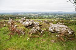 LabbanasigheWedge tomb · 437 yd
Explorer Tom Labbanasighe is basically a prehistoric wedge-shaped loaf of bread that got left in the oven for three thousand years.…
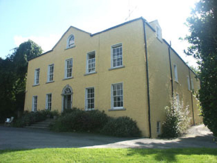 Money HouseCountry house · 1.4 mi
Explorer Tom Money House in Money Upper is hiding a massive fortune that turns out to be an empty biscuit tin. It’s a big, plain…
 Graveyard1.4 mi
Explorer Tom The graveyard in Aghowle Lower has been hosting the dead since St. Finnian set up shop there, which is a lot of time…
 Aghowle Church (in Ruins)Church · 1.4 mi
Explorer Tom Aghowle Church has had more names than I've had jobs in my life, which is saying something about its career path. St.…
 Sycamore1.4 mi
Explorer Tom Sycamore in County Wicklow is bragging about surviving a storm that probably only had a light drizzle, acting like it…
 European Beech1.4 mi
Explorer Tom European Beech in County Wicklow was prophesied to become a giant disco ball but sadly the budget ran out before the…
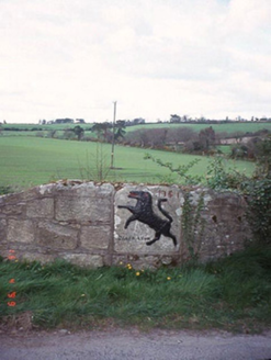 monument1.9 mi
Explorer Tom The Monument in Craans is just a plaque from 1751 with a lion motif, probably marking an old inn where people got…
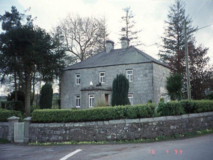 Blacklion Constabulary BarrackRic barracks · 1.9 mi
Explorer Tom Blacklion Constabulary Barrack in Craans used to house RIC officers who probably snored louder than the hipped roof…
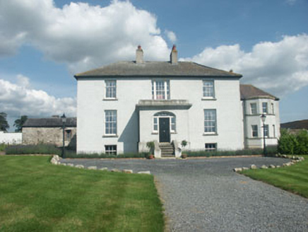 Raheengraney HouseCountry house · 2.2 mi
Explorer Tom Raheengraney House would post photos of its open rural setting with the caption 'No Wi-Fi but great vibes'. It’s a…
 Saint Brigid's Catholic ChurchChurch/chapel · 3.8 mi
Explorer Tom Saint Brigid's Catholic Church in Clonegall has a reredos that looks like it was decorated by a very confused Victorian…
 The Glebe HouseRectory/glebe/vicarage/curate's house · 3.9 mi
Explorer Tom The Glebe House in Clonegall is the quiet uncle at a wedding who knows all the secrets. It’s been housing vicars since…
 Huntington Castle & GardensHeritage attraction · 4.1 mi
Explorer Tom Huntington Castle & Gardens is deeply suspicious of the postman, who allegedly delivered a letter from Napoleon one…
More mountains and hills in County Wicklow · All of County Wicklow

What do you know about this place?Tap to add a comment or ask a question