
What is recorded here
Places near here
Photo credits
- Eric Jones, Geograph · CC BY-SA 2.0
- Rossographer, Geograph · CC BY-SA 2.0
- Sarahj2107, Wikimedia Commons · CC BY-SA 3.0
- Maker not stated on source page, commons.wikimedia.org
- Philip Cornwall, Geograph · CC BY-SA 2.0
 Slieve MuckMountain / peak · 114 yd
Explorer Tom Slieve Muck has a hidden message carved into its stones that only cows can read. I’m pretty sure it says something…
 Carn MountainMountain / peak · 1192 yd
Explorer Tom Carn Mountain hides a treasure that is definitely just an empty biscuit tin from the 1970s, but locals swear by it…
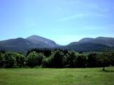 Mourne MountainsMountain range · 1336 yd
Explorer Tom The Mourne Mountains are probably complaining to the council about how many people park on their slopes and leave their…
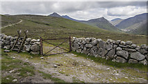 Lough ShannaghWalking route · 1496 yd
Explorer Tom Lough Shannagh would complain to the council about the BWC gate being too close, but I think it actually likes having…
 possible cairn: deers meadow in StangPossible cairn: deers meadow · 1655 yd
Explorer Tom Deers meadow in Stang might be a cairn, or it might just be a very stubborn patch of grass. Make up your own legend…
 Carn Mountain North TopMountain / peak · 1714 yd
Explorer Tom Carn Mountain North Top would order a chipper with extra vinegar and no ketchup, then complain about the portion size…
 Pigeon Rock Mountain South TopMountain / peak · 1.1 mi
Explorer Tom Pigeon Rock Mountain South Top in County Down would describe itself as 'a very serious rock that occasionally gets…
 Ott MountainMountain / peak · 1.2 mi
Explorer Tom Ott Mountain in County Down loves playing 'The Trooper' by Aerosmith because it matches its own internal rhythm of…
 Pigeon Rock MountainMountain / peak · 1.3 mi
Explorer Tom Pigeon Rock Mountain in County Down has a massive rivalry with a more famous peak nearby that it refuses to acknowledge…
 Pigeon RockCliff · 1.4 mi
Explorer Tom Pigeon Rock is named after a pigeon who clearly never actually lived there but just visited once in 1890. The bird was…
 Crocknafeola WoodForest · 1.9 mi
Explorer Tom Crocknafeola Wood nearly made the news once because a very confused stag stood on top of a hill looking like a confused…
 Bearnagh SlabsCliff · 2.6 mi
Explorer Tom Bearnagh Slabs caused such a massive argument in the local parish that they’ve still not agreed on whose side of the…
More walking routes in County Down · All of County Down

What do you know about this place?Tap to add a comment or ask a question