What is recorded here
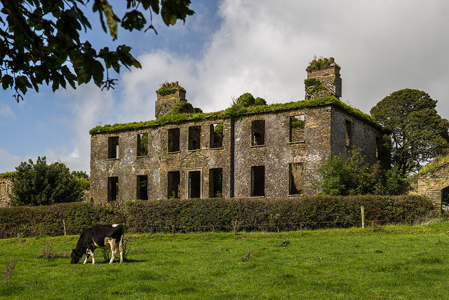
Ruined rectangular house of 2 storeys over basement; dry moat gives light to basement. Hipped roof entirely gone but two tall off-centre chimney stacks stand to full height. String course just above basement level on all external walls; weather-slating above this survives in parts. Entrance front (S) of 7 bays with 3-bay central breakfront; central door with plain limestone surround approached by flight of steps over moat. Rear elevation (N) of 7 bays with tall central round-headed window, small diamond-shaped window beneath. Broad side elevations of only 2 bays. Pair of domed brick ovens (int. diam. c. 1.2m) adjacent to fireplace in basement. Stone plaque on E wall of house, immediately above string course, has following inscription: 'M. Hannah Hutchingson otherwise/Mary Mother to Massy Hutchingson Esq/laid the foundation stone of this/building May the 1st 1783/carved by Con O Donoghue/Engraver. Extending out at right angle fromsides of house are high walls connecting with S end walls of long 2-storey farmbuildings which form E and W range of farmyard to rear. S elevations are ornate, with Venetian and Diocletian windows and brick detail. Range to E recently abandoned as dwelling; W range has pigeon holes at 1st-floor level. Both ranges have central pedimented breakfront.
The above description is derived from the published 'Archaeological Inventory of County Cork. Volume 3: Mid Cork' (Dublin: Stationery Office, 1997). In certain instances the entries have been revised and updated in the light of recent research.
Date of upload/revision: 14 January 2009
The monument record does not grant public access. Check the route and ask the landowner before entering private land.
- What survives
- Recorded monument
Places near here
 KilnKiln, lime · 739 yd
 Corn MillMill, corn · 847 yd
 Burial Gd (Disused)Burial ground · 1004 yd
 Macroom WalksVisitor information · 1199 yd
 Macroom Castle (in Ruins)Castle, tower house · 1348 yd
 Fulacht fia in Gurteenroe (muskerry West By.)Fulacht fia · 1352 yd
 Neill's WoodWood · 1544 yd
 Battle of Macroombattle · 1555 yd
 Ummera WoodWood · 1.8 mi
 Clonavrick CliffCliff · 2.6 mi
 Dundareirke Castle (in Ruins)Castle, tower house · 2.6 mi
 BurrenMountain / peak · 4.0 mi
Other information
Photo: Mike Searle · CC BY-SA 2.0