
What is recorded here
From the National Monuments Service (Archaeological Survey of Ireland) record ME023-012
Places near here
Photo credits
- Maker not stated on source page, commons.wikimedia.org
- National Inventory of Architectural Heritage
- Maker not stated on source page, www.pinterest.com
- Maker not stated on source page, en.wikipedia.org
- Maker not stated on source page, ru.pinterest.com
- Maker not stated on source page, www.alamy.com
- Maker not stated on source page, www.dreamstime.com
- Maker not stated on source page, www.irishcentral.com
- surrealpenguin, Wikimedia Commons · CC BY-SA 2.0
 Girley CemeteryGraveyard · 321 yd
Explorer Tom Girley Cemetery is convinced the map makers drew it three feet to the left because they were hungover and guessing.…
 Catholic Church of the Immaculate ConceptionChurch/chapel · 360 yd
Explorer Tom This church has been having a screaming match with the rain for two hundred years. It stands there in Girley looking…
 Holy well in GirleyHoly well · 525 yd
Explorer Tom Holy well in Girley gave up carbonated drinks for Lent, which is basically everything these days. It’s kept itself…
 Native Woodland Trust: Girley Bog ReserveWood · 839 yd
Explorer Tom Girley Bog Reserve is a place where the interesting work is often happening at your feet. In County Meath, wet ground…
 Megalithic tomb in Drewstown GreatMegalithic tomb · 1.2 mi
Explorer Tom Megalithic tomb in Drewstown Great is sitting on a demesne like it owns the place. It’s basically a stone table setting…
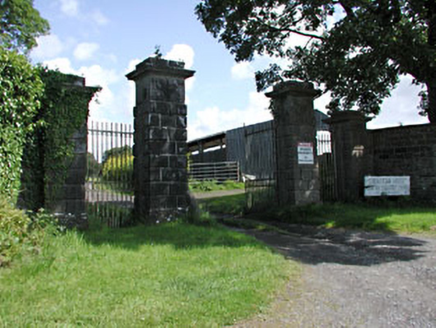 Drewstown HouseDemesne walls/gates/railings · 1.5 mi
Explorer Tom Drewstown House gates are acting like they’re guarding a royal palace, not just a quiet spot in County Meath. The…
 Embanked enclosureFairy fort / earthen ringfort · 1.8 mi
Explorer Tom Embanked enclosure in Garistown would tell you after three pints that it actually used to be a very fancy dance floor.…
 Fairy fort / earthen ringfort in Martinstown (lune By.)Fairy fort / earthen ringfort · 2.0 mi
Explorer Tom Fairy fort in Martinstown would buy a boat and sail it in circles if it won the lotto. It’s shaped like a D, which is…
 Memorial stone in RathmoreMemorial stone · 2.5 mi
Explorer Tom Memorial stone in Rathmore, County Meath swears locals touch it for luck before exams, which is probably nonsense but…
 Clonmellon GraveyardGraveyard · 3.9 mi
Explorer Tom Clonmellon Graveyard in County Westmeath claims its unlikely celebrity friend was a famous pirate who just needed a…
 Dervotstown CastleCastle, tower house · 4.2 mi
Explorer Tom Dervotstown Castle is gone, but its spirit lives on in a very confused scarecrow that thinks it's still teaching…
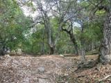 Persian Walnut4.8 mi
Explorer Tom Persian Walnut in County Westmeath wants 'Lived Large' on its tombstone because it has been producing some seriously…
More archaeology and monuments in County Meath · All of County Meath

What do you know about this place?Tap to add a comment or ask a question