What is recorded here
Close to the foot of a large limestone scarp c. 125m S of the village of Bun Gabhla, Inis Mór. Two parallel grassed-over banks of earth and stone running N-S and c. 8m apart (each: L 20m, Wth 5m, H 3m). There is a hut (GA110-001----) c. 70m to S. (Robinson 1980)
The above description is derived from the published 'Archaeological Inventory of County Galway Vol. I - West Galway'. Compiled by Paul Gosling (Dublin: Stationery Office, 1993).
Date of upload: 05 August 2010
The monument record does not grant public access. Check the route and ask the landowner before entering private land.
- What survives
- Recorded monument
Places near here
 Scoil Náisiúnta Eoin Pól IIschool · 1677 yd
 monumentmonument · 1681 yd
 Castle (in ruins)Castle, unclassified · 1.2 mi
 AharlaLeacht · 1.2 mi
 Dun OnaghtFairy fort / stone ringfort · 1.2 mi
 An tOileán ThiarIslet · 1.7 mi
 Kilmurvey BeachBeach / strand · 2.0 mi
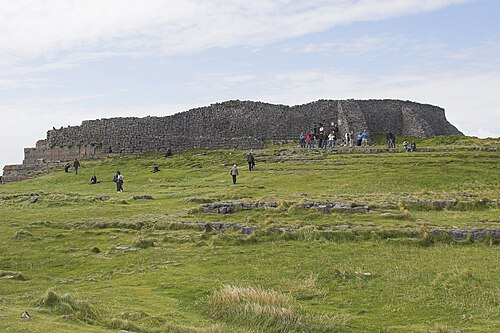 Dún AonghasaNature reserve · 2.0 mi
 ÁrainnIsland · 3.5 mi
 Seal Colony LookoutViewpoint · 3.9 mi
 An CharcairMountain / peak · 3.9 mi
 Trá na mBuailte (Beach of the Booly)Beach / strand · 5.7 mi