
What is recorded here
Situated on a knoll on a NE-facing slope. Listed as ‘Church’ in the SMR (1992) and the RMP (1996). Only the N wall of this 18th-century church survives. It was built in 1793-4 by the ‘Moravian Brethern’ who had been invited to the area by a resident family (Swinfen 1992, 95). They left in 1796 during the unrest before the 1798 Rebellion. The surviving wall (aligned WNW-ESE; Wth 0.62m; int. L 14.07m; H c. 4m) shows three built-in arches, each 3.2m wide, separated by piers (Wth 1.25m). It has an external plinth. All that remains of the S wall is a wide mound (Wth 6.4m; H 0.5m). There is one lintelled doorway (Wth 1.1m; H 1.75m) within the central arch. A plaque in Irish was placed on one of the piers in 1994 commemorating the 200th anniversary of the building of the church.
Compiled by: Mary Tunney
Date of upload: 8 June 2016
The monument record does not grant public access. Check the route and ask the landowner before entering private land.
- What survives
- Recorded monument
Places near here
 CaherFairy fort / stone ringfort · 268 yd
 ‘De Clare’s House (in ruins)’ (1842 )Bawn · 738 yd
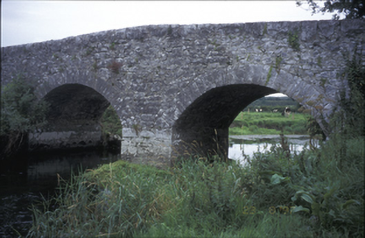 Poplar Bridgebridge · 906 yd
 Sheela-na-gig in KillinaboySheela-na-gig · 965 yd
 Kilinaboy Church (in ruins)Church · 969 yd
 Castle (in ruins)Castle, tower house · 1071 yd
 Fergus River CaveCave · 1650 yd
 Inchiquin IslandIslet · 1.1 mi
 Rock IslandIsland · 1.2 mi
 Farbrega RockNamed rock · 3.4 mi
 Battle of TullyodeaBattlefield · 4.2 mi
 European ashEuropean ash · 4.9 mi
Other information
Photo: Credit not shown in the picture search · Rights wording not checked; contact us if this picture should be removed