What is recorded here
Monzie 2 is a cup marked stone in Perth and Kinross, Scotland.
Places near here
Photo credits
- Robert Struthers, Wikimedia Commons · CC BY-SA 2.0
- David Brown, Wikimedia Commons · CC BY-SA 2.0
- Dave Fergusson, Wikimedia Commons · CC BY-SA 2.0
- Russel Wills, Wikimedia Commons · CC BY-SA 2.0
- Harry Turner, Wikimedia Commons · CC BY-SA 2.0
- Eirian Evans, Wikimedia Commons · CC BY-SA 2.0
- Euan Nelson, Wikimedia Commons · CC BY-SA 2.0
- Richard Webb, Wikimedia Commons · CC BY-SA 2.0
- Eusebius, Wikimedia Commons · CC BY 3.0
- Jim Barton, Wikimedia Commons · CC BY-SA 2.0
 MonzieCairnfield, Enclosure, Hut Circle(s) (prehistoric), Rig and Furrow (medieval) - (post Medieval), Round Ended Building · 303 yd
 Loch MoraigHut Circle (prehistoric), Ring Ditch House (prehistoric) · 780 yd
 1st Marquis of Montrose MemorialMemorial · 1.0 mi
 AldandulishFarmstead, Head Dyke (post Medieval) · 1.2 mi
 Tirinie HouseHouse · 1.4 mi
 Creag EallaichMountain / peak · 1.6 mi
 Meall Dail MìnMountain / peak · 1.7 mi
 ClunebegNo Class (event) (21st Century) · 2.2 mi
 The Balvenie PillarVisitor information · 2.2 mi
 Dalginross WoodWood · 2.3 mi
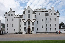 Siege of Blair CastleBattle · 2.4 mi
 Atholl Country Life MuseumMuseum · 2.6 mi
More archaeology and monuments in Perth and Kinross · All of Perth and Kinross

What do you know about this place?Tap to add a comment or ask a question