
What is recorded here
Montrose, North Esk Road, The Tower is a house in Angus, Scotland.
From the Historic Environment Scotland record 36265
The historic-place record does not grant public access. Check current conditions and ownership before entering land or a building.
Places near here
Photo credits
- Leslie Barrie, Wikimedia Commons · CC BY-SA 2.0
- Stanley Howe, Wikimedia Commons · CC BY-SA 2.0
- JThomas, Wikimedia Commons · CC BY-SA 2.0
- Bill Harrison, Wikimedia Commons · CC BY-SA 2.0
- Scott Cormie, Wikimedia Commons · CC BY-SA 2.0
- Adrian Diack, Wikimedia Commons · CC BY-SA 2.0
- friedfish, Wikimedia Commons · Public domain
 Montrose, North Esk RoadGeneral View · 71 yd
 MontroseFindspot, Seal · 155 yd
 North Esk RoadNo Class (event) · 178 yd
 Montrose, 36 the MallHouse (19th Century) · 193 yd
 Montrose, Rosehill Road, Rosehill CemeteryCemetery (19th Century) · 296 yd
 Montrose, the MallGeneral View · 343 yd
 Montrose, Dorward HouseNo Class (event) · 596 yd
 Jamieson Paton FountainMemorial · 774 yd
 Montrose AcademyVisitor information · 1367 yd
 Montrose Basin Wildlife CentreVisitor information · 1.7 mi
 Craig HouseCastle (medieval), Country House · 1.8 mi
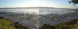 Montrose Basin Local Nature ReserveNature reserve · 1.8 mi
More historic places in Angus · All of Angus
What do you know about this place?