
What is recorded here
Montrose, High Street, Town House is a town house in Angus, Scotland.
From the Historic Environment Scotland record 36271
The historic-place record does not grant public access. Check current conditions and ownership before entering land or a building.
Places near here
 Montrose, 113 High StreetBuilding (19th Century), Shop · 35 yd
 Montrose, High Street, Old Parish ChurchChurch (12th Century), War Memorial (20th Century) (1923) · 41 yd
 Joseph Hume StatueMonument · 68 yd
 MontroseLong Cist (early Medieval) · 114 yd
 Queen's Close, MontroseNo Class (event) · 120 yd
 Robert Peel StatueMemorial · 125 yd
 James Graham StatueMemorial · 149 yd
 Montrose, Mill RoadNo Class (event) (21st Century) · 208 yd
 Montrose AcademyVisitor information · 317 yd
 Montrose Basin Wildlife CentreVisitor information · 1.2 mi
 Craig HouseCastle (medieval), Country House · 1.2 mi
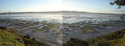 Montrose Basin Local Nature ReserveNature reserve · 1.7 mi
Pictures: Adrian Diack, Wikimedia Commons · CC BY-SA 2.0; Michael Dibb, Wikimedia Commons · CC BY-SA 2.0; Leslie Barrie, Wikimedia Commons · CC BY-SA 2.0; Richard Webb, Wikimedia Commons · CC BY-SA 2.0; Richard Sutcliffe, Wikimedia Commons · CC BY-SA 2.0; Douglas Nelson, Wikimedia Commons · CC BY-SA 2.0; Ann Harrison, Wikimedia Commons · CC BY-SA 2.0; Stanley Howe, Wikimedia Commons · CC BY-SA 2.0; friedfish, Wikimedia Commons · Public domain
More historic places in Angus · All of Angus
What do you know about this place?