What is recorded here
Monintown castle stood on the southern boundary of its townland in County Westmeath, belonging to Sir Thomas Nugent in 1640 before the 1659 Down Survey mapped its stones. The exact structure has vanished, but Monintown House still occupies roughly the same ground, suggesting people kept returning to that particular edge where Multyfarnham parish met Stonehall. Whatever the castle contained or defended, the land remembered the shape of it well enough to build again beside the old line.
Unlocated castle within the townland of Monintown which is depicted on the 1659 Down Survey map of Multyfarnham parish (NLI MS 723-4). In 1640 this castle was the property of Sir Thomas Nugent (ibid.). On the Down Survey map the castle is depicted standing on the S boundary line of the townland of Monintown which also marks the parish boundary with Stonehall. Monintown House is located in roughly the same area where the medieval castle is depicted on the Down Survey map.
Compiled by: Caimin O'Brien
Date of upload: 21 September 2016
Sir Thomas Nugent held Monintown Castle in 1640, and it is recorded on the 1659 Down Survey, highlighting its presence in the Multyfarnham parish during the 17th century. Its significance lies in its historical association with the Nugent family, a prominent Gaelic-Irish dynasty in Ulster.
The monument record does not grant public access. Check the route and ask the landowner before entering private land.
- What survives
- Recorded monument
Places near here
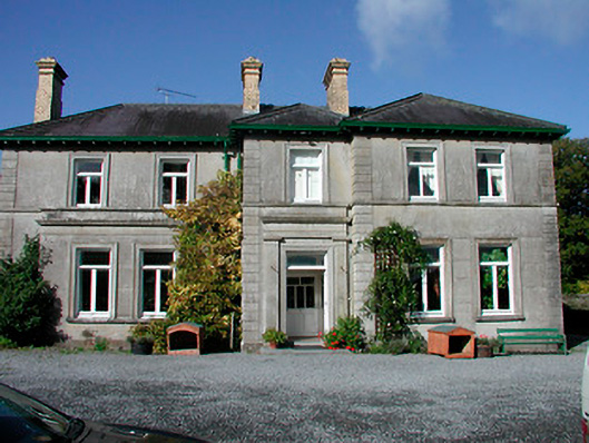 Mornington Housecountry house · 340 yd
 Hachured, RathbrackFairy fort / earthen ringfort · 1278 yd
 Stonehallhouse · 1622 yd
 Enclosure in BallinridderaEnclosure · 1.1 mi
 KnockeyonMountain / peak · 1.4 mi
 Mortimer's CastleArchaeological place · 1.6 mi
 CastleCastle, motte · 2.0 mi
 Bridge Memorial (Kenna)Memorial · 2.5 mi
 Scragh Bog Nature ReserveNature reserve · 3.4 mi
 Long PlantingForest · 4.0 mi
 Church IslandIsland · 4.3 mi
 Srudarra IslandIslet · 5.0 mi