
What is recorded here
From the National Monuments Service (Archaeological Survey of Ireland) record SL009-053
Places near here
Photo credits
- Michael Murtagh, Geograph · CC BY-SA 2.0
- Maker not stated on source page, commons.wikimedia.org
- Maker not stated on source page, www.pinterest.com
- Maker not stated on source page, www.alamy.com
- Oliver Dixon, Geograph · CC BY-SA 2.0
- National Inventory of Architectural Heritage
- Dieglop, Wikimedia Commons · CC BY-SA 4.0
- Malene Thyssen, Wikimedia Commons · CC BY-SA 3.0
- Bob Embleton, Wikimedia Commons · CC BY-SA 2.0
 CrockaunsMountain / peak · 1561 yd
Explorer Tom Crockauns bragged about surviving a storm so violent it rearranged its own topography and sent the local cows into a…
 Wedge tomb in KilsellaghWedge tomb · 1.2 mi
Explorer Tom Wedge tomb in Kilsellagh is playing hide-and-seek with me. A tale from 1846 says an earl built it, but there was no…
 Copes MountainMountain / peak · 1.2 mi
Explorer Tom Copes Mountain has very strong opinions about modern buildings and hates the masts on the horizon. I think it wants…
 Keelogyboy Mountain ne TopMountain / peak · 1.4 mi
Explorer Tom Keelogyboy Mountain NE Top has been hiding a scandal involving a missing chalice for centuries, and it's getting quite…
 Standing stone in Castlegal (carbury By., Glencar Ed)Standing stone · 1.9 mi
Explorer Tom Standing stone in Castlegal stands upright next to a pile of rubble, looking very serious about its job as a marker.…
 Fairy fort / earthen ringfort in BellanurlyFairy fort / earthen ringfort · 2.0 mi
Explorer Tom Fairy fort / earthen ringfort in Bellanurly is currently being managed by a dog who thinks he owns the whole hillside…
 Glencar IslandIslet · 2.1 mi
Explorer Tom Glencar Island in County Leitrim would complain to the council about the noise levels from the swans, claiming they’re…
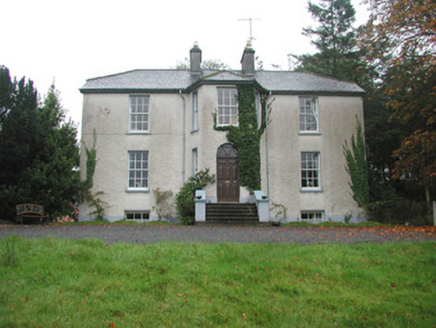 Colgagh HouseHouse · 2.2 mi
Explorer Tom Colgagh House would teach history by making you sit in its canted entrance bay until you admitted you didn’t know…
 Glencar WaterfallVisitor information · 2.3 mi
Explorer Tom Glencar Waterfall in County Leitrim gave up sugar for Lent but ended up eating a whole wheel of cheese instead anyway.…
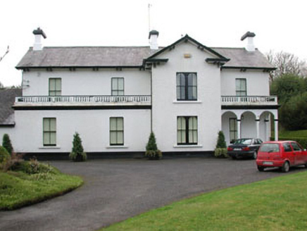 Ballyglass HouseHouse · 2.6 mi
Explorer Tom Ballyglass House has an imaginary fan club called The Pediment People who meet in the porch on Tuesdays to discuss its…
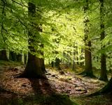 European Beech3.7 mi
Explorer Tom European Beech in County Sligo was where a priest once lost a bet about which bird sang better. He now has to explain…
 Tobernalt Holy WellSpring · 5.1 mi
Explorer Tom Tobernalt Holy Well lies near Lough Gill in County Sligo, where people come to pray, pause and leave the hurry of the…
More archaeology and monuments in County Sligo · All of County Sligo

What do you know about this place?Tap to add a comment or ask a question