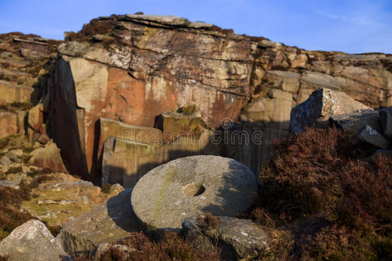
What is recorded here
On E side of Quitrentmountain, straddling county boundary with Limerick and looking E to Quern Hill (see 15254). Bedrock of conglomerate. Series of overgrown quarried depressions, roughly circular in shape but varying in size and depth (diam. 3m-14m; D c. 2m-3m); some still containing a partially-worked millstone. Other millstones were quarried from very shallow hollows or made from rock outcrop. Conglomerate millstones on site vary in size (diam. 0.91m-1.45m; T 0.20m-0.38m); some have central perforation (diam. c. 0.21m), bored from both sides; others have unfinished bore holes. Some millstones were removed from their quarried positions but abandoned further down mountain side. Runner quern stone and saddle quern noted in nearby farmhouse.
The above description is derived from the published 'Archaeological Inventory of County Cork. Volume 4: North Cork' (Dublin: Stationery Office, 2000). In certain instances the entries have been revised and updated in the light of recent research.
Date of upload/revision: 14 January 2009
The monument record does not grant public access. Check the route and ask the landowner before entering private land.
- What survives
- Recorded monument
Places near here
 IndicatedHouse, vernacular house · 1440 yd
 CarrigeenamronetyMountain / peak · 1.0 mi
 Millstone quarry in Boleynanoultagh,gortacurrig (condons and Clongibbon By.)Millstone quarry · 1.1 mi
 Coolfree MountainMountain / peak · 1.1 mi
 Fulacht fia in Quitrent MountainFulacht fia · 1.1 mi
 Fulacht fia in BoleynanoultaghFulacht fia · 1.5 mi
 ToberpatrickSpring · 2.0 mi
 Site of CastleCastle, unclassified · 2.4 mi
 North Meadow WoodForest · 2.6 mi
 Castletown Castle (Site of)Castle, unclassified · 2.7 mi
 Horse Field WoodForest · 2.8 mi
 Flat cemetery in Ballyenahan NorthFlat cemetery · 4.1 mi
Other information
Photo: Credit not shown in the picture search · Rights wording not checked; contact us if this picture should be removed