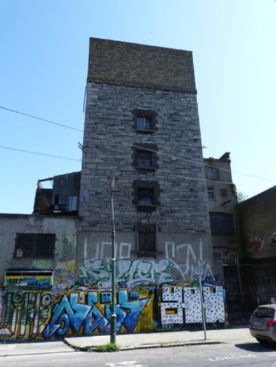
What is recorded here
Attached single-bay four-storey former mill and stores, built c.1875, with four-bay elevation to east, single-bay extension to south and four-bay two-storey extension to north. Now disused. Pitched slate roof to east end and flat roofs to entrance block and west end, hipped slate roof to southern extension hidden behind moulded red brick parapet, cast-iron rainwater goods throughout, moulded brick coping to east elevation. Yellow brick, laid in English garden wall bond, over squared rubble limestone walls with squared limestone quoins. Smooth rendered walls to ground floor to west elevation. Cast-iron wall ties. Red brick quoins to east elevation. Roughcast rendered walls to extension to north. Smooth rendered wall to extension to south. Square-headed window openings having red brick surrounds, granite sills and replacement timber casement windows, some blocked. Segmental-headed window openings to extension to south, granite or timber sills, blocked. Segmental-headed carriage arch to ground floor to west elevation of south extension. Located on the east side of Creighton Street.
Creighton Street appears but is not named on eighteenth-century maps of Dublin. It was named Ordnance Lane in the early nineteenth century as it was the site of the Ordnance Stores. This site was vacant in the 1840s, however a wind powered corn mill and associated structures occupied the remainder of the block between Hanover Street and Windmill Lane. The mill buildings were extended towards Creighton Street in the 1870s and Walter Brown & Company Flour Millers is recorded at 20 Creighton Street and 1 Hanover Street from 1874. The structure is well-executed in squared limestone rubble, its brick dressings adding subtle tonal and textural contrast to the otherwise utilitarian design. The height of the entrance block contrasts with the domestic scaled buildings elsewhere on Creighton Street. Despite some later extensions this building is a reminder of the type of industrial buildings that would once have characterised the area.
From the Buildings of Ireland (National Inventory of Architectural Heritage) record 50020475
This does not grant access. Most recorded buildings are privately owned; view them only from public ground unless the owner allows entry.
Places near here
Photo credits
- National Inventory of Architectural Heritage
- wrobell, Wikimedia Commons · CC BY-SA 3.0
- William Murphy, Wikimedia Commons · CC BY-SA 2.0
- AlBa344, Wikimedia Commons · CC BY-SA 4.0
- N Chadwick, Geograph · CC BY-SA 2.0
- Eric Jones, Geograph · CC BY-SA 2.0
- Agence Rol, Wikimedia Commons · Public domain
- Angilbas at English Wikipedia, Wikimedia Commons · Public domain
- Superchilum, Wikimedia Commons · CC BY-SA 4.0
- Diliff, Wikimedia Commons · CC BY-SA 4.0
- Adam Jones from Kelowna, BC, Canada, Wikimedia Commons · CC BY-SA 2.0
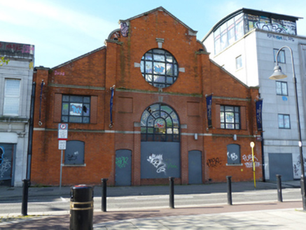 Bushell Ltd. FurnitureStore/warehouse · 110 yd
 office112 yd
.jpg/250px-Jeanie_Johnston_(Dublin_Bay).jpg "Photo: wrobell, Wikimedia Commons · CC BY-SA 3.0") Jeanie JohnstonMuseum · 254 yd
Jeanie JohnstonMuseum · 254 yd Epic The Irish Emigration MuseumMuseum · 354 yd
_-_20180824203248.jpg/250px-County_Dublin_-_Famine_(Dublin)_-_20180824203248.jpg "Photo: AlBa344, Wikimedia Commons · CC BY-SA 4.0") Famine MemorialMemorial · 411 yd
Famine MemorialMemorial · 411 yd Matt Talbot 1856-1925Memorial · 438 yd
 Samuel Beckett BridgeVisitor information · 478 yd
 Burning of the Custom HouseArmed conflict · 616 yd
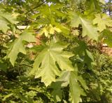 Bigleaf Maple647 yd
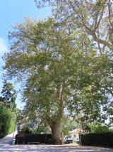 Oriental plane653 yd
 Library in Unknown TownlandLibrary · 796 yd
.jpg/250px-Architectural_Detail_-_Trinity_College_-_Dublin_-_Ireland_-_02_(42589562215).jpg "Photo: Adam Jones from Kelowna, BC, Canada, Wikimedia Commons · CC BY-SA 2.0") College in Unknown TownlandCollege · 842 yd
College in Unknown TownlandCollege · 842 ydMore historic places in County Dublin · All of County Dublin
What do you know about this place?