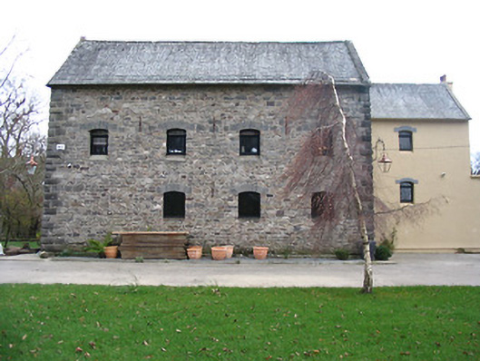
What is recorded here
Corn mill complex, c.1775, including:(i) Detached four-bay two-storey over basement mill with half-attic. Extended, c.1850, comprising five-bay two-storey parallel range along rear (south) elevation forming single-bay two-storey recessed end bay to right. Decommissioned, pre-1948. In use as offices, post-1948.…
Read the whole record
From the Buildings of Ireland (National Inventory of Architectural Heritage) record 12317081
Places near here
Photo credits
- National Inventory of Architectural Heritage
- Humphrey Bolton, Geograph · Creative Commons Attribution-ShareAlike 2.0
- Maker not stated on source page, www.geograph.ie
- A.-K. D., Wikimedia Commons · CC BY-SA 4.0
- Andy Ryan / 1803 Productions, credited by Kilkenny GAA, kilkennygaa.ie
- Maker not stated on source page, www.dreamstime.com
- Gerd Eichmann, Wikimedia Commons · CC BY-SA 4.0
- Maker not stated on source page, commons.wikimedia.org
- Maker not stated on source page, en.wikipedia.org
- Maker not stated on source page, ca.pinterest.com
- Andreas F. Borchert, Wikimedia Commons · CC BY-SA 4.0
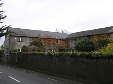 Friars HillHouse · 256 yd
Explorer Tom Friars Hill in Grenan claims a poet once fell into the ditch right next door. It was built from a warehouse, so it…
 Grenan Flour MillMill manager's house · 273 yd
Explorer Tom Grenan Flour Mill manager’s house has a New Year's resolution to stop being so stuffy about flour dust. It still smells…
 Graveyard in GrenanGraveyard · 700 yd
Explorer Tom Graveyard in Grenan is famous for the time the whole parish argued about which stone was actually important. They…
 Font in CloghabrodyFont · 769 yd
Explorer Tom Font in Cloghabrody hears the walls whispering about old O'Tunney workshop gossip. It’s been sitting there listening to…
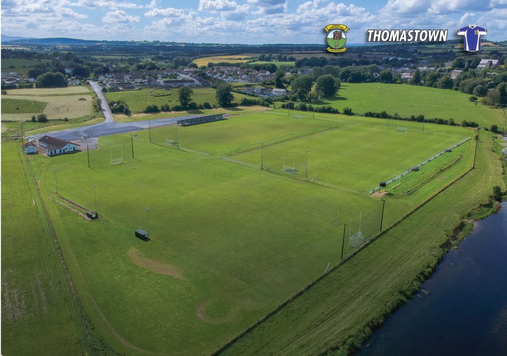 Thomastown GAA pitchGAA ground · 868 yd
 Mapped cemeteryCemetery · 966 yd
Explorer Tom Mapped cemetery in County Kilkenny thinks the shortcut through the hedge is the only way to get anywhere, which is…
 CastleCastle, Anglo-Norman masonry castle · 1096 yd
Explorer Tom Castle in Grenan is having a silent argument with the nearest tree about who's taller. It's an Anglo-Norman masonry…
 Castle ViewPicnic place · 1248 yd
Explorer Tom Castle View has strict rules that you must look at the castle while eating, otherwise your sandwich doesn’t count as a…
 Linear earthwork in Jerpoint WestLinear earthwork · 1389 yd
Explorer Tom Linear earthwork in Jerpoint West smells like wet mud and ancient boredom, according to my sensitive nose. It’s a line…
 Colmkille GraveyardVisitor information · 1696 yd
Explorer Tom Colmkille Graveyard is hosting a very exclusive party where the foxes have taken charge of the guest list. Apparently…
 Jerpoint AbbeyHeritage attraction · 1.0 mi
Explorer Tom Jerpoint Abbey had land stretching across roughly 14,000 acres before Henry VIII's officials brought its monastic life…
 Holy WellSpring · 1.1 mi
Explorer Tom Holy Well got its location wrong on the map because the surveyor was three pints deep and thought the hill looked like…
More historic places in County Kilkenny · All of County Kilkenny

What do you know about this place?Tap to add a comment or ask a question