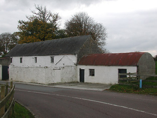
What is recorded here
Detached four-bay two-storey corn mill, c.1800, with square-headed carriageway to ground floor, and originally with single-bay single-storey gabled projecting end bay to right. Part refenestrated, c.1925. Now in use as outbuilding. Pitched slate roof with clay ridge tiles, and cast-iron rainwater goods. Limewashed (whitewashed) random rubble limestone walls. Square-headed window openings with no sills, timber lintels, rendered surrounds to ground floor, and replacement fixed-pane steel windows, c.1925, having some casement sections. Square-headed carriageway to ground floor with rendered surround, and replacement timber panelled double doors. Set back from line of road with painted roughcast lime rendered boundary wall to forecourt having iron double gates.(ii) Attached two-bay single-storey barrel-roofed outbuilding, c.1925, to north. Barrel-vaulted corrugated-iron roof with cast-iron rainwater goods. Limewashed (whitewashed) roughcast walls. Square-headed window opening with no sill, concealed dressings, and fixed-pane steel window. Square-headed door openings with concealed timber lintels, and timber boarded doors.
A modest-scale corn mill representing an important element of the industrial legacy of Ballyragget having supported the local agricultural economy since the late eighteenth or early nineteenth century. Although having been adapted to accommodate an alternative use most of the original composition qualities survive in place together with most of the historic fabric including increasingly-rare steel fittings to the openings, thereby enhancing the character of the streetscape.
This does not grant access. Most recorded buildings are privately owned; view them only from public ground unless the owner allows entry.
Places near here
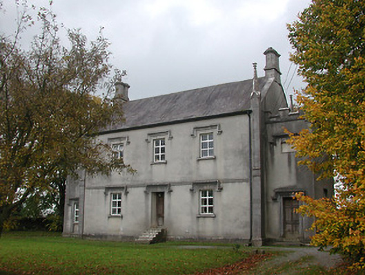 Ballyragget National Schoolschool · 40 yd
 Ballyragget Br.Bridge · 151 yd
 Ballyragget Cas.Castle, tower house · 574 yd
 Enclosure in BallyraggetEnclosure · 831 yd
 QuarryEnclosure · 1233 yd
 Moat Castle (site of)Archaeological place · 1.1 mi
 Donaghmore WellSpring · 1.2 mi
 Graveyard in SraleaghGraveyard · 1.5 mi
 Anker's IslandIsland · 1.8 mi
 Emma Jane Browne-ClaytonMemorial · 4.4 mi
 Red horse-chestnutRed horse-chestnut · 4.5 mi
 Freshford LoopWalking route · 5.0 mi
Other information
Photo: National Inventory of Architectural Heritage · Website use allowed for educational or private purposes with source credit