Places near here
Photo credits
- Sharkzy, Wikimedia Commons · CC0
- Albert Bridge, Geograph · CC BY-SA 2.0
- HENRY CLARK, Wikimedia Commons · CC BY-SA 2.0
- Robert Ashby, Geograph · CC BY-SA 2.0
- Eric Jones, Geograph · CC BY-SA 2.0
- Kip471, Wikimedia Commons · Public domain
- Geoff McHugh, Geograph · CC BY-SA 2.0
- HENRY CLARK, Geograph · CC BY-SA 2.0
 Ruins of Clare CastleRuins · 260 yd
Explorer Tom Ruins of Clare Castle in County Armagh hosted a dance where someone definitely broke a hip and nobody apologized. The stones are still twitching slightly from the memory of the bad music. Pop by and tell it it's looking well.
Fortification: Clare Castle in ClareFortification: Clare Castle · 270 ydExplorer Tom Fortification: Clare Castle in Clare gave up meat for Lent back in the seventeenth century and has never quite forgiven the weather for making it damp ever since. It’s just a stubborn bit of fortification standing in the mud, looking deeply unimpressed by your existence. Walk past slowly like you're in a film.
 Clare GlenWood · 568 yd
Explorer Tom Clare Glen in County Armagh is the site of a fairy dispute over parking rights near the weir. The Cusher flows right to left, but the fairies argue about direction. Tell the next person you meet it's haunted. It might be.
 Glen View TrailWalking route · 655 yd
Explorer Tom Glen View Trail in County Armagh swears that if you step left three times and right once, you’ll find a lost sock. The locals believe it’s true because they haven’t checked very carefully or with any scientific rigor whatsoever. Pretend it's yours and plan the housewarming.
 Clare BridgeBridge · 852 yd
Explorer Tom Clare Bridge in County Armagh would teach history if it had to, but it prefers to just watch cars go by. It's seen more than your ex has. Go back in winter, it's a different animal.
 Tandragee CastleCountry House · 1.8 mi
Explorer Tom Tandragee Castle is just a fancy house that thinks it’s royalty, probably complaining about the damp to anyone who will listen. It’s trying too hard to look mysterious, which is cute in a bad way. Pick a stone, any stone, and invent its biography right now.
 Newry Canal WayWalking route · 3.0 mi
Explorer Tom Newry Canal Way thinks tourists from Dublin are all talk and no walk, mostly because they spend more time on their phones than looking at the water. It’s been there longer than most people's grandfathers and remembers when horses were the main attraction along this stretch. Give it a pat on the way past, it's had a long life.
 Scarva MemorialMemorial · 3.1 mi
Explorer Tom Scarva Memorial has strict rules for visitors that involve staying quiet and not touching anything, which is standard but annoying. The four guys on the obelisk are judging your posture right now. Look for the ghost, then pretend you didn't.
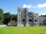 Gosford Forest ParkForest · 3.4 mi
Explorer Tom Gosford Forest Park swears it was here before the castle, which is convenient because the castle has no proof of its age. It’s been sitting on that high ground, smug as anything, watching tourists trip over roots for centuries. Whisper a secret at it, it's kept worse.
 Multiperiod church site & graveyard: st. john's in MullaghbrackMultiperiod Church Site & Graveyard: St. John's · 3.6 mi
Explorer Tom St. John's in Mullaghbrack hosted a dance that went too far and never fully recovered. It spans from early Christian to modern times, which means it’s seen every trend fail. Bring curiosity, leave with a better story than mine.
 Dane's CastArchaeological place · 3.6 mi
Explorer Tom Dane's Cast again, this one claims it makes a haunting moan at night, but I think it’s just indigestion from eating too many stones. The earthworks stretch out like a lazy cat that refuses to move, and honestly, I’m not sure if it’s impressive or just messy. Stand back, squint, and it looks like a castle.
 Richhill War MemorialMemorial · 5.2 mi
Explorer Tom Richhill War Memorial in County Armagh would ace a job interview by pointing out its stability, lack of burnout, and excellent track record of standing still. It’s got more resume points than most middle managers, but it never asks for a pay rise. It's free, it's odd, what more do you want?
More historic places in County Armagh · All of County Armagh

What do you know about this place?Tap to add a comment or ask a question