
What is recorded here
Middleton Farm is a drain in Renfrewshire, Scotland.
From the Historic Environment Scotland record 82378
The historic-place record does not grant public access. Check current conditions and ownership before entering land or a building.
Places near here
Photo credits
- Richard Sutcliffe, Wikimedia Commons · CC BY-SA 2.0
- Thomas Nugent, Wikimedia Commons · CC BY-SA 2.0
- Lairich Rig, Wikimedia Commons · CC BY-SA 2.0
- Richard Webb, Wikimedia Commons · CC BY-SA 2.0
- G Laird, Wikimedia Commons · CC BY-SA 2.0
- Jonathan Thacker, Wikimedia Commons · CC BY-SA 2.0
- Rosser1954, Wikimedia Commons · CC BY-SA 4.0
 Linwood, Candren Road, ChoiceleaBungalow (20th Century) (possible) · 1021 yd
 Linwood, Moss RoadTramway (19th Century) · 1052 yd
 Linwood, Bridge Street, Gospel HallHall (mid 20th Century) - (late 20th Century), Nonconformist Meeting House (late 20th Century) · 1216 yd
 Paisley, Linwood Road, St James Business CentreOffice(s) · 1440 yd
 Paisley Moss Local Nature ReserveNature reserve · 1.2 mi
 WWI Belgian Refugees War MemorialMemorial · 1.4 mi
 Millennium Milepost Black Cart WaterVisitor information · 1.4 mi
 Wallace MemorialMemorial · 1.4 mi
 Paisley Museum and Art GalleriesMuseum · 1.9 mi
 Elderslie, Abbey RoadNo Class (event) · 1.9 mi
 East FulwoodNo Class (event) (21st Century) · 1.9 mi
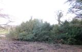 Craigends YewEuropean Yew · 2.0 mi
More historic places in Renfrewshire · All of Renfrewshire
What do you know about this place?