
What is recorded here
From the National Monuments Service (Archaeological Survey of Ireland) record DG003-003
Places near here
Photo credits
- Golfing in Ireland; photographer not stated, Source publisher
- Maker not stated on source page, golfparexcellence.com
- Maker not stated on source page, ru.pinterest.com
- Kenneth Allen, Wikimedia Commons
- National Inventory of Architectural Heritage
- Maker not stated on source page, au.pinterest.com
- Kenneth Allen, Geograph · CC BY-SA 2.0
- Dr Neil Clifton, Geograph · CC BY-SA 2.0
- Wanfried-Dublin, Wikimedia Commons · CC BY-SA 4.0
- Maker not stated on source page, en.wikipedia.org
 Ballyliffin Golf ClubGolf course · 952 yd
 Ballyliffin Golf Club RestaurantRestaurant · 957 yd
Explorer Tom Ballyliffin Golf Club Restaurant is where golfers eat after losing their balls in the bushes and feeling a bit…
 Standing stone in Carrowreagh or CraignacallyStanding stone · 1048 yd
Explorer Tom Standing stone in Carrowreagh Or Craignacally stands 1.27m high on the north slopes of Craigawannia, right next to the…
 Pollan BaySurfing beach · 1662 yd
Explorer Tom Pollan Strand runs from Ballyliffin towards the Isle of Doagh, with Glashedy Island offshore and waves that give…
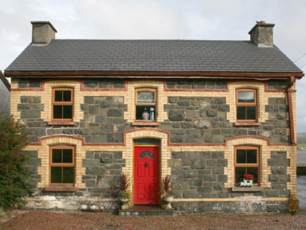 railway station1.2 mi
Explorer Tom This railway station in Rashenny is dressed up in a gorgeous clash of dark stone and bright yellow brick. It served the…
 Stone row in RashennyStone row · 1.5 mi
Explorer Tom Stone row in Rashenny is a line of stones on marshy ground, looking like they’re trying not to sink into the bog. A…
 Nancy's BarnCafé · 1.6 mi
Explorer Tom Nancy's Barn serves fish that looks like it hasn't moved since the Ice Age. It would complain to the council about the…
 Oratory of the AssumptionChurch/chapel · 1.7 mi
Explorer Tom Oratory of the Assumption popped up around c. 1950, just as Ballyliffin stopped being a quiet hamlet and started proper…
Ballyliffin HotelHotel · 1.8 miExplorer Tom Ballyliffin Hotel number one is probably the quiet one next to the church, hiding a love story that went badly wrong.…
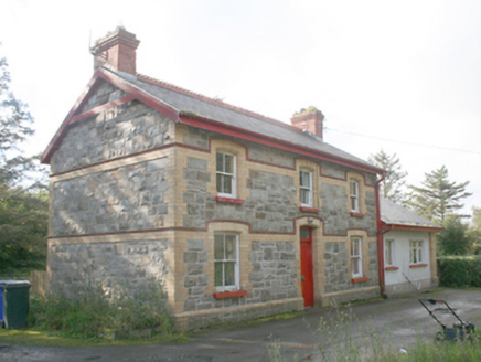 Ballyliffin Railway StationRailway station · 1.8 mi
Explorer Tom Ballyliffin Railway Station is a proper survivor from that short-lived narrow-gauge era, built around 1900. The yellow…
 Magheranaul Wedge TombWedge tomb · 1.8 mi
Explorer Tom Magheranaul Wedge Tomb has a single roofstone covering its gallery, with an hour-glass hole bored right through the…
 Crockaughrim CairnCairn, unclassified · 2.0 mi
Explorer Tom Crockaughrim Cairn is a heather-covered oval sitting right near the summit, looking suspiciously like a stone pile.…
More archaeology and monuments in County Donegal · All of County Donegal

What do you know about this place?Tap to add a comment or ask a question