
What is recorded here
Numerous bronze pins as well as a variety of stone tools have been found among the sandhills close to Ballyness Pier (UJA 1858, 351-3; Knowles 1901, 34.8; Brunicardi 1914, 195). The above description was derived from the 'Archaeological Survey of County Donegal. A description of the field antiquities of the County…
Read the whole record
From the National Monuments Service (Archaeological Survey of Ireland) record DG024-001
Places near here
Photo credits
- National Inventory of Architectural Heritage
- Maker not stated on source page, tr.pinterest.com
- Maker not stated on source page, au.pinterest.com
- Maker not stated on source page, www.alamy.com
- Golfing in Ireland; photographer not stated, Source publisher
- Donegal Daily; individual photographer not named on the article, www.donegaldaily.com
- Maker not stated on source page, readymap.irish
- Maker not stated on source page, www.pinterest.com
- Rossographer, Wikimedia Commons
- Vadim Manuylov, Wikimedia Commons · CC BY-SA 3.0
- Ronnie Nijboer, Wikimedia Commons · CC0
- Picture: Go Visit Donegal
 Cé Bhaile an Easa [Ballyness Pier]Pier/jetty · 63 yd
Explorer Tom Ballyness Pier is called Cé Bhaile an Easa, which sounds like a sneeze in Irish, and it was built during the famine…
 Megalithic tomb in Baile An EasaMegalithic tomb · 901 yd
Explorer Tom Megalithic tomb in Baile An Easa is known as Dermot and Grania's Bed. In 1845, Fagan found it reclaimed by the earth…
 An Glaidhb Burial Ground TraditionGraveyard · 1303 yd
Explorer Tom An Glaidhb Burial Ground Tradition rests on a whisper, not a wall. Farmers found bones while ploughing near Ballyness…
 Church in An Glaidhb (tc Na Croisbhealaí)Church · 1343 yd
Explorer Tom Church in An Glaidhb is recorded through local tradition, not described as a surviving church building. The account…
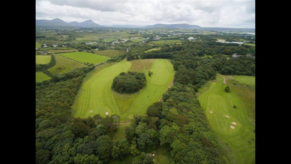 Cloughaneely Golf ClubGolf course · 1.1 mi
 Páirc Naomh Fionnán, Cloughaneely GAAGAA ground · 1.1 mi
 Strand Road CafePub · 1.1 mi
Explorer Tom Strand Road Cafe in County Donegal is listed as a pub? Confusing! I like confusion. Grab me a coffee or a beer…
 Strand Road Bar & KitchenPub · 1.1 mi
Explorer Tom Strand Road Bar & Kitchen in County Donegal would tell any job interviewer that its key skill is surviving the rain…
 Trá Dhroim na TineBeach / strand · 1.1 mi
Explorer Tom Trá Dhroim na Tine gives Falcarragh a broad sandy stage, with Ballyness Bay in front and Donegal hills waiting behind…
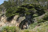 Monterey Cypress1.2 mi
Explorer Tom Monterey Cypress in County Donegal is always getting picked on by the wind because it stands out like a sore thumb on…
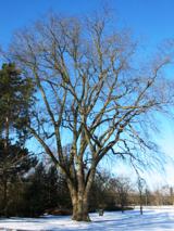 Wych Elm1.2 mi
Explorer Tom Wych Elm is writing a strongly worded letter to the council complaining about the noise from the new traffic lights…
 An tSean BharicVisitor information · 1.2 mi
Explorer Tom An tSean Bheairic in Falcarragh has the glorious nerve to turn an old barracks into a place for art, conversation…
More archaeology and monuments in County Donegal · All of County Donegal

What do you know about this place?Tap to add a comment or ask a question