What is recorded here
Mount Sandel in County Derry held a Mesolithic settlement where people lived before writing, before kings, and before most of Ireland stopped being wilderness. The site is scheduled, meaning the state still treats those old stones and soils as worthy of protection. Imagine children running past reeds, adults reading water and weather, and a whole life occurring without leaving a single name behind.
The official Northern Ireland record identifies this as MESOLITHIC SETTLEMENT SITE: MOUNT SANDEL. Recorded period: MESOLITHIC; PREHISTORIC. Recorded protection: Scheduled. The official map point was placed at the centre of the recorded archaeological site from the source map reference.
The monument record does not grant public access. Check the route and ask the landowner before entering private land.
- What survives
- Recorded monument
Places near here
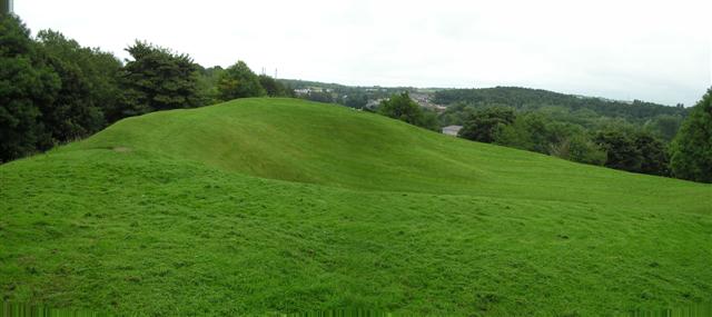 PREHISTORIC SETTLEMENT SITE, MOTTE, PROMONTORY FORT & ARTILLERY FORT: MOUNTSANDEL FORT in Mount SandelPREHISTORIC SETTLEMENT SITE, MOTTE, PROMONTORY FORT & ARTILLERY FORT: MOUNTSANDEL FORT · 67 yd
 Mount Sandel FortArchaeological place · 71 yd
 Somerset ForestForest · 991 yd
 Terrace Row Presbyterian ChurchChurch · 1396 yd
 Congregational ChurchChurch · 1696 yd
 Castleroe WoodWood · 1.1 mi
 Millennium MilepostVisitor information · 1.2 mi
 Quilley Picnic AreaPicnic place · 3.4 mi
 CASTLE & SETTLEMENT SITE (unlocated) in GlebeCASTLE & SETTLEMENT SITE (unlocated) · 3.9 mi
 Portstewart StrandBeach / strand · 5.0 mi
 CHURCH & GRAVEYARD: BALLYWILLIN in GlebeCHURCH & GRAVEYARD: BALLYWILLIN · 5.0 mi
 FORTIFIED HOUSE in ProspectFORTIFIED HOUSE · 5.6 mi