
What is recorded here
From OpenStreetMap (© OpenStreetMap contributors) n524745257
Places near here
Photo credits
- Colin Kinnear, Wikimedia Commons · CC BY-SA 2.0
- David Brown, Wikimedia Commons · CC BY-SA 2.0
- Oliver Dixon, Wikimedia Commons · CC BY-SA 2.0
- Maker not stated on source page, www.flickr.com
- Iain Russell, Wikimedia Commons · CC BY-SA 2.0
- Billy McCrorie, Wikimedia Commons · CC BY-SA 2.0
- Richard Webb, Wikimedia Commons · CC BY-SA 2.0
- James Johnstone, Wikimedia Commons · CC BY-SA 2.0
- Chris Newman, Wikimedia Commons · CC BY-SA 2.0
 Mid BurnClearance Cairn(s), Head Dyke (post Medieval), Hut Circle(s) (prehistoric) · 1.1 mi
Explorer Tom Mid Burn in Dumfries and Galloway has clearance cairns, a head dyke, and hut circles, which is quite a lot to fit in…
 KnockendochMountain / peak · 1.3 mi
 Boreland HillMountain / peak · 1.3 mi
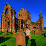 New AbbeyPygmy Cup · 1.4 mi
Explorer Tom New Abbey is hiding a pygmy cup that’s smaller than my pride after eating three pies. The whole parish probably argued…
 CriffelMountain / peak · 1.5 mi
 Douglas' CairnMarker Cairn · 1.5 mi
Explorer Tom Douglas' Cairn in Dumfries and Galloway is a marker cairn that would survive a zombie attack by simply not moving. It’s…
 Bail FellMountain / peak · 1.6 mi
 Ryes PlantationFarmstead · 1.7 mi
Explorer Tom Ryes Plantation has a long list of former names and is currently in an identity crisis about being a farmstead. It’s…
 Loch KindarQuern · 1.7 mi
Explorer Tom Loch Kindar isn’t just water; it’s a giant stone quern that got lazy and stopped grinding grain. The map says it’s only…
 Boreland of SouthwickFarmstead (19th Century) · 1.8 mi
Explorer Tom Boreland of Southwick holds the unofficial world record for having the most boring name that sounds like a sneeze. It’s…
 TannochFarmstead, Field System · 1.8 mi
Explorer Tom Tannoch took approximately four million cups of tea to build, mostly because the architect kept getting distracted by…
 Drumburn HillMountain / peak · 1.8 mi
More mountains and hills in Dumfries and Galloway · All of Dumfries and Galloway

What do you know about this place?Tap to add a comment or ask a question