What is recorded here
The official Northern Ireland record identifies this as MEGALITHIC TOMB. Recorded period: PREHISTORIC. The official map point was placed at the centre of the recorded archaeological site from the source map reference.
Megalithic tomb; likely dating to the Neolithic or Early Bronze Age. Its significance lies in its contribution to understanding prehistoric burial practices and megalithic architecture in the region.
The monument record does not grant public access. Check the route and ask the landowner before entering private land.
- What survives
- Recorded monument
Places near here
 Spences MountainMountain / peak · 1.2 mi
 CHURCH (in ruins); GRAVEYARD and ENCLOSURE: ST.MARY'S or BALLACHANERY or BLOODY BRIDGE in Ballaghanery UpperCHURCH (in ruins); GRAVEYARD and ENCLOSURE: ST.MARY'S or BALLACHANERY or BLOODY BRIDGE · 1.2 mi
 Bloody Bridge (new)Bridge · 1.3 mi
 Bloody Bridge, (old)Bridge · 1.3 mi
 Chimney Rock MtnMountain / peak · 1.4 mi
 Round SeefinViewpoint · 1.9 mi
 Annalong WoodForest · 2.3 mi
 CASHEL?: OLD CASTLE (unlocated) in GlasdrummanCASHEL?: OLD CASTLE (unlocated) · 2.4 mi
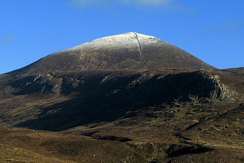 Slieve DonardMountain / peak · 2.4 mi
 MULTIPLE CIST CAIRN: LESSER CARN in Ballaghbeg; Ballyaghanery UpperMULTIPLE CIST CAIRN: LESSER CARN · 2.4 mi
 Annalong ButtressCliff · 2.6 mi
 Drinneevar LoopWalking route · 2.6 mi