What is recorded here
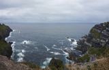
This site, overlooking the Atlantic to W, is located in rough upland pasture on the SW slopes of Bolus mountain, just below the saddle that extends NE-SW. It consists of a raised rectangular area, 7m NW-SE x 5.3m NE-SW, which is delimited by a rough stone kerb. Most of the kerb stones are set on edge and they average .2m x .5m x .4m thick. The earthen interior is raised approximately .5m above surrounding ground level. The site is locally referred to as the 'Giant's Grave'. O'Sullivan and J. Sheehan (compilers), 'The Iveragh peninsula: an archaeological survey of South Kerry'. Cork University Press (1996), no. 1471.
This site, overlooking the Atlantic to W, is located in rough upland pasture on the SW slopes of Bolus mountain, just below the saddle that extends NE-SW. It consists of a raised rectangular area, 7m NW-SE x 5.3m NE-SW, which is delimited by a rough stone kerb. Most of the kerb stones are set on edge and they average .2m x .5m x .4m thick. The earthen interior is raised approximately .5m above surrounding ground…
From the National Monuments Service (Archaeological Survey of Ireland) record KE096-018
The monument record does not grant public access. Check the route and ask the landowner before entering private land.
- What survives
- Recorded monument
Places near here
Photo credits
- Michael Earnshaw, Geograph · CC BY-SA 2.0
- Martin Creek, Wikimedia Commons · CC BY-SA 2.0
- Jose Antonio Gutierrez D., Wikimedia Commons · CC BY-SA 4.0
- Derek Harper, Wikimedia Commons · CC BY-SA 2.0
- Phil Champion, Geograph · CC BY-SA 2.0
- Chris06, Wikimedia Commons · Public domain
- Rod Allday, Geograph · CC BY-SA 2.0
- kevin higgins, Wikimedia Commons · CC BY-SA 2.0
- Marco Ober, Wikimedia Commons · CC BY-SA 4.0
- Matthew Chadwick, Geograph · CC BY-SA 2.0
- M J Richardson, Wikimedia Commons · CC BY-SA 2.0
- Commander-pirx, Wikimedia Commons · CC BY-SA 4.0
 Bolus PointHeadland · 1474 yd
 Ceann BhólaisHeadland · 1.1 mi
 Wedge tomb in An Com (bar. Uíbh Ráthach)Wedge tomb · 1.9 mi
 Chaytor's StablesRuins · 2.3 mi
 Ballinskelligs PrioryVisitor information · 2.8 mi
 Ballinskelligs Abbey (in ruins)Religious house, Augustinian canons · 2.8 mi
 Ballinskelligs Castle (in Ruins)Castle, tower house · 3.0 mi
 Tobairin Holy WellSpring · 4.6 mi
 Kerry CliffsHeritage attraction · 5.4 mi
 Scarriff IslandIsland · 5.7 mi
 Scarriff IslandMountain / peak · 5.8 mi
_-_20170724_16_24_56.jpg/250px-Kerry_-_Fermoyle_Castle_(Iveragh)_-_20170724_16_24_56.jpg "Photo: Commander-pirx, Wikimedia Commons · CC BY-SA 4.0") Fermoyle Castle (in Ruins)Castle, tower house · 6.0 mi
Fermoyle Castle (in Ruins)Castle, tower house · 6.0 miMore archaeology and monuments in County Kerry · All of County Kerry
What do you know about this place?