What is recorded here
English St. in Armagh likely marked a clustered settlement where ordinary life continued through the Late Medieval and Post-Medieval periods, perhaps reaching back into Early Christian times. The name suggests a narrow residential or commercial street rather than a grand ceremonial centre, yet the layering of periods implies that houses, workshops or worship spaces were rebuilt and reused across centuries. People may have lived, traded and buried one another within the same compact area long before the street received its present identity.
The official Northern Ireland record identifies this as MEDIEVAL & possibly EARLY CHRISTIAN SETTLEMENT SITE: ENGLISH ST.. Recorded period: E.CHRIST.; LATE-MED; POST-MED. The official map point was placed at the centre of the recorded archaeological site from the source map reference.
The monument record does not grant public access. Check the route and ask the landowner before entering private land.
- What survives
- Recorded monument
Places near here
 Battle of ClontibretMajor battlefield · 79 yd
 First Trust BankBank · 92 yd
 CHURCH: ST COLUMBA'S in CorporationCHURCH: ST COLUMBA'S · 96 yd
 MULTIPERIOD CHURCH SITE & GRAVEYARD with ROUND TOWER, BIVALLATE ENCLOSURE & LIBRARY, now CATHEDRAL: CHURCH of the ELECTIONS, ST. PATRICK'S CATHEDRAL in CorporationMULTIPERIOD CHURCH SITE & GRAVEYARD with ROUND TOWER, BIVALLATE ENCLOSURE & LIBRARY, now CATHEDRAL: CHURCH of the ELECTIONS, ST. PATRICK'S CATHEDRAL · 158 yd
 Abbey StreetVisitor information · 162 yd
 No 5 Vicars' HillMuseum · 188 yd
 Boer War memorialMemorial · 276 yd
 Crimean CannonMemorial · 281 yd
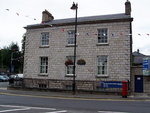 Royal Irish Fusiliers MuseumMuseum · 307 yd
 Battle of the Yellow FordMajor battlefield · 380 yd
 Armagh FriaryArchaeological place · 574 yd
 Cannon HillViewpoint · 3.3 mi