
What is recorded here
The official Northern Ireland record identifies this as CHURCH: ST COLUMBA'S. Recorded period: UNCERTAIN. The official map point was placed at the centre of the recorded archaeological site from the source map reference.
The monument record does not grant public access. Check the route and ask the landowner before entering private land.
- What survives
- Recorded monument
Places near here
 First Trust BankBank · 16 yd
 Battle of ClontibretMajor battlefield · 74 yd
 Methodist ChurchChurch · 81 yd
 Abbey StreetVisitor information · 118 yd
 MULTIPERIOD CHURCH SITE & GRAVEYARD with ROUND TOWER, BIVALLATE ENCLOSURE & LIBRARY, now CATHEDRAL: CHURCH of the ELECTIONS, ST. PATRICK'S CATHEDRAL in CorporationMULTIPERIOD CHURCH SITE & GRAVEYARD with ROUND TOWER, BIVALLATE ENCLOSURE & LIBRARY, now CATHEDRAL: CHURCH of the ELECTIONS, ST. PATRICK'S CATHEDRAL · 236 yd
 No 5 Vicars' HillMuseum · 238 yd
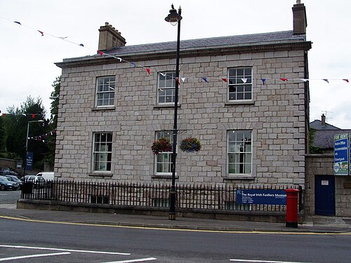 Royal Irish Fusiliers MuseumMuseum · 282 yd
 Boer War memorialMemorial · 295 yd
 Crimean CannonMemorial · 304 yd
 Battle of the Yellow FordMajor battlefield · 387 yd
 Armagh FriaryArchaeological place · 670 yd
 Cannon HillViewpoint · 3.3 mi
Other information
Photo: Credit not shown · Copyright shown; no reuse licence shown