Places near here
Photo credits
- Michael Earnshaw, Geograph · CC BY-SA 2.0
- Martin Creek, Wikimedia Commons · CC BY-SA 2.0
- Jose Antonio Gutierrez D., Wikimedia Commons · CC BY-SA 4.0
- Derek Harper, Wikimedia Commons · CC BY-SA 2.0
- Phil Champion, Geograph · CC BY-SA 2.0
- Chris06, Wikimedia Commons · Public domain
- Martin Creek, Wikimedia Commons
- Rod Allday, Geograph · CC BY-SA 2.0
- Shaun Ferguson, commons.wikimedia.org
- Marco Ober, Wikimedia Commons · CC BY-SA 4.0
- Matthew Chadwick, Geograph · CC BY-SA 2.0
- Commander-pirx, Wikimedia Commons · CC BY-SA 4.0
 Bolus PointHeadland · 865 yd
Explorer Tom Bolus Point is a headland where locals swear if you wink at the Skelligs in the distance, they’ll wink back, though…
 Ceann BhólaisHeadland · 1.1 mi
Explorer Tom Ceann Bhólais is looking down its nose at tourists from Dublin, thinking they’re all just here to find the best pint in…
 Wedge tomb in An Com (bar. Uíbh Ráthach)Wedge tomb · 2.2 mi
Explorer Tom Wedge tomb in An Com thinks one massive roof stone makes it look cool and mysterious. A goat used to rule this place…
 Chaytor's StablesRuins · 2.4 mi
Explorer Tom Chaytor's Stables saw its most dramatic moment when a horse sneezed so hard it blew the roof off, or so the legend…
 Ballinskelligs PrioryVisitor information · 3.4 mi
Explorer Tom Ballinskelligs Priory is still fuming about a love affair that went spectacularly wrong right next door in the medieval…
 Ballinskelligs Abbey (in ruins)Religious house, Augustinian canons · 3.4 mi
Explorer Tom Ballinskelligs Abbey would teach history by screaming about how it moved from a dangerous rock to this safer shore.…
 Ballinskelligs BeachSurfing beach · 3.5 mi
Explorer Tom Ballinskelligs Beach spreads beneath the old castle with enough sand for a grand entrance and a very quick lesson in…
 Ballinskelligs Castle (in Ruins)Castle, tower house · 3.5 mi
Explorer Tom Ballinskelligs Castle in Baile An Sceilg has strict rules: no dogs, no hats, and absolutely no asking it how its day…
 St Michael's-Foilmore GAA pitchGAA ground · 3.9 mi
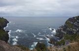 Kerry CliffsHeritage attraction · 5.0 mi
Explorer Tom The Kerry Cliffs near Portmagee have a serious grudge against the weather for keeping them looking so perpetually wet…
 Scarriff IslandIsland · 6.3 mi
Explorer Tom Scarriff Island means rugged, and that is a fairer advertisement than any glossy promise I could write. About 366 acres…
 Fermoyle Castle (in Ruins)Castle, tower house · 6.3 mi
Explorer Tom Fermoyle Castle in Formaoil is still sulking about losing its walls to the elements. It wants a rematch with Ross…
More cliffs, bays and coast in County Kerry · All of County Kerry

What do you know about this place?Tap to add a comment or ask a question